Hiking the Trans Swiss Trail – Stage 21 Erstfeld to Wassen

Stage 21 of the Trans Swiss trail is 19 km long with 1000 m ascent and 540 m descent and goes from Erstfeld to Wassen. The description of this hike said that “the Urnertal seems like a transit corridor.” “Seems like a transit corridor” is very much an understatement as the road, the railway, the river, the trail and the power lines are all squeezing their way though this narrow valley. Even with all the transit ways, this was still a very beautiful area and we very much enjoyed hiking this section.

| Where: | Erstfeld to Wassen Canton Uri, Switzerland |
| Train/Bus: | Zürich HB -> Erstfeld – 1 hr 25 min Wassen, Dorf -> Zürich HB – 2 hr 2 min |
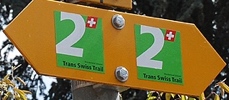
| What: | Trans Swiss Trail – Stage 21 – Erstfeld to Wassen Yellow trail markers – Trans Swiss Trail Route 2 |
| Skill: | Medium – About 6 hrs Length 19 km, Ascent 1000 m, Descent 540 m |
| Stage 1 – Porrentruy to St-Ursanne Stage 2 – St-Ursanne to Soubey Stage 3 – Soubey to Saignelégier Stage 4 – Saignelégier to St-Imier Stage 5 – St-Imier to Chézard-St-Martin Stage 6 – Chézard-St-Martin to Neuchâtel Stage 7 – Neuchâtel to Murten Stage 8 – Murten to Laupen Stage 9 – Laupen to Bern Stage 10 – Bern to Worb Stage 11 – Worb to Lützelflüh Stage 12 – Lützelflüh to Langnau i.E. Stage 13 – Langnau i.E. to Eggiwil Stage 14 – Eggiwil to Schangnau Stage 15 – Schangnau to Sörenberg Stage 16 – Sörenberg to Giswil Stage 17 – Giswil to Flüeli-Ranft Stage18 – Flüeli-Ranft to Stans Stage 19 – Stans to Seelisberg Stage 20 – Seelisberg to Erstfeld Stage 21 – Erstfeld to Wassen Stage 22 – Wassen to Andermatt Stage 23 – Andermatt to Passo del San Gottardo Stage 24 – Passo del San Gottardo to Airolo Stage 25 – Airolo to Osco Stage 26 – Osco to Anzonico Stage 27 – Anzonico to Biasca Stage 28 – Biasca to Bellinzona Stage 29 – Bellinzona to Tesserete Stage 30 – Tesserete to Lugano (Comano) Stage 31 – Lugano (Paradiso) to Morcote Stage 32 – Morcote to Mendriso |
Getting There
The Trans Swiss Trail is best done with public transportation as each stage starts and ends at different points. Stage 21 picks right up where stage 20 left off, at the Erstfeld train station.


After a short walk through town, we were back at the Reuss river and back to the main trail.
The Trail
The trail starts out by following alongside the Reuss river, but after just a few kilometers it heads up into the fields above. One of the interesting things here were the many stone walls lining the path (picture 4 below). I don’t think we have seen anything quite like these stone walls before.


One thing we have seen a lot of though, are the tiny little chapels like the one in picture two. It is often worth a peek inside to see the artwork.


When we came to the town of Silenen, we spent some time exploring the stone tower there. It was open and we were able to climb the criss-crossed stairs inside to get a peek out of the windows at the top.


As we continued the trail, there were multiple signs about local military and industry history. We passed a large bunker and the hydroelectric power plant at Amsteg.


At this point, we were almost half-way through the hike and it was getting to be lunch time. We found a nice bench with a view (picture 2 below) and had our picnic lunch. We didn’t linger long because the mosquitos were out in force.


It is very clear what and important transportation pass this area is. As the valley got narrower, we could see how the rail line, the river, the highway, and the power lines were all being squeezed through.
On a lot of other hikes, we have came across self-service cheese stores. On this stage, I was surprised at how many self-service rock crystal stands we came across.


At Gurtnellen, the trail descended steeply down to the river, and this is where the hanging bridge the trail description warned hikers about. My husband is somewhat afraid of heights, but he didn’t find this bridge too scary even though it wobbled a bit.


After criss-crossing the river on the bridges by Gurtnellen, the trail then follows directly alongside the road. I was glad when we left the roadside and were back down along the river. We crossed yet another bridge and got some lovely views up and down the valley.


As we approached Wassen, we passed a second hydroelectric plant (picture 2).The color of the water here was just so striking.


The trail then began a climb up and way from river and towards Wassen.
Getting Back
At Wassen, we only had about two minutes before our bus arrived. Very good timing on our part.


During the bus ride back, we basically followed along the trail we had just hiked. It was interesting to see it all again from a different perspective. After several long sections (20, 25, and 19 km), the next section is very short, just 10 km. I’m looking forward to it!


Leave a Reply