Hiking the Trans Swiss Trail – Stage 27 Anzonico to Biasca

Stage 27 of the Trans Swiss trail is 18 km long with 440 m ascent and 1150 m descent and goes from Anzonico to Biasca. This stage, like stage 25 and stage 26, is part of the Alta Strada trail (“high street” in Italian) and it wends its way high up on the valley side passing through forests and small mountain towns before a final steep descent into the valley. I wasn’t sure about hiking this trail in February, but after a string of dry above freezing days, I checked the snow coverage maps and decided to give it a try. Although the trail was dry (no mud, ice, or snow), there were sections covered deeply in dry leaves that were much slipperier and trickier to walk though than I expected. Despite that, we had a great time. The views were stunning!

| Where: | Anzonico to Biasca Canton Ticino, Switzerland |
| Train/Bus: | Zürich HB -> Anzonico, Paese – 2 hr 59 min Biasca-> Zürich HB – 2 hr 2 min |
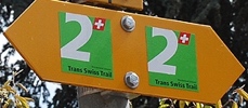
| What: | Trans Swiss Trail – Stage 27 – Anzonico to Biasca Red and white trail markers – Trans Swiss Trail Route 2 |
| Skill: | Difficult – About 5 hrs 30 min Length 18 km, Ascent 440 m, Descent 1150 m |
| Stage 1 – Porrentruy to St-Ursanne Stage 2 – St-Ursanne to Soubey Stage 3 – Soubey to Saignelégier Stage 4 – Saignelégier to St-Imier Stage 5 – St-Imier to Chézard-St-Martin Stage 6 – Chézard-St-Martin to Neuchâtel Stage 7 – Neuchâtel to Murten Stage 8 – Murten to Laupen Stage 9 – Laupen to Bern Stage 10 – Bern to Worb Stage 11 – Worb to Lützelflüh Stage 12 – Lützelflüh to Langnau i.E. Stage 13 – Langnau i.E. to Eggiwil Stage 14 – Eggiwil to Schangnau Stage 15 – Schangnau to Sörenberg Stage 16 – Sörenberg to Giswil Stage 17 – Giswil to Flüeli-Ranft Stage18 – Flüeli-Ranft to Stans Stage 19 – Stans to Seelisberg Stage 20 – Seelisberg to Erstfeld Stage 21 – Erstfeld to Wassen Stage 22 – Wassen to Andermatt Stage 23 – Andermatt to Passo del San Gottardo Stage 24 – Passo del San Gottardo to Airolo Stage 25 – Airolo to Osco Stage 26 – Osco to Anzonico Stage 27 – Anzonico to Biasca Stage 28 – Biasca to Bellinzona Stage 29 – Bellinzona to Tesserete Stage 30 – Tesserete to Lugano (Comano) Stage 31 – Lugano (Paradiso) to Morcote Stage 32 – Morcote to Mendriso |
Getting There
The Trans Swiss Trail is best done with public transportation as each stage starts and ends at different points. Stage 27 picks up right where stage 26 left off, at the Anzonico, Paese bus stop.


The Anzonico, Paese bus stop has an incredible view! We took a few minutes to admire it before turning around and heading up the trail.
The Trail
This stage, like stages 25 and 26, is part of the Alta Strada trail (“high street” in Italian) and the first 10 km or continues along high above the valley. The view from the bus stop was an excellent preview of what we would see as we hiked. Absolutely beautiful views of the mountains across the way for almost the entire hike.


The first 10 km or so had some elevation change but nothing drastic. A bit of up and down, but mostly easy hiking. We did cross a few frozen streams but the small amount of ice was easy to avoid.


The trail passes through the towns of Cavagnago and Sobrio. Both towns have bus stops, so if you just want to do a short section of this hike (and skip the steep descent of the second half), you easily could. I didn’t really look for restaurants as we had packed a lunch, but I think there is at least one in Sobrio. We stopped at a bench along the way for our picnic and picture 3 was our lunch view. While we ate lunch, it had started to rain, so we didn’t linger. The rain, fortunately, was not very heavy and we even saw a rainbow.


The views from this trail really are outstanding.


As we started to get into the second half of the trail, the trail became a bit trickier. I had watched the weather and checked the snow coverage maps and things looked pretty good, and for the most part they were – no mud, ice, or snow. But, there were sections covered deeply in dry leaves that were very slippery and tricky to walk through. It really slowed us down.


The stone houses of the small villages we passed were very charming. During the second half of the hike, the steep descent began. I was very glad to have my hiking poles for balance. I love this view down into the valley.

The trail was all steep stone steps down to the town of Pollegio. From there, we still had another 45 minutes or so walk to the train station in Biasca.


After a pleasant stroll riverside, we left the river and headed into Biasca.
Getting Back
As we walked through Biasca, it was so striking to see the palm trees and brightly colored houses.


This was a another great hike. The three sections (25, 26, and 27) that make up the Alta Strada would make a wonderful summer hike and I may want to do this part again some time. Although, I do think I might take the bus in Sobrio and end the hike there, the final steep descent was a bit much. On to the next stage, which looks to be completely flat river walk. Looking forward to it!


Leave a Reply