Hiking the Trans Swiss Trail – Stage 3 Soubey to Saignelégier
Continuing our hike-though of the Trans Swiss Trail this past weekend, we completed stage 3, Soubey to Saignelégier. At 12 km, this stage was a relatively short hike, but with an 800 m gain in altitude, it was not an easy hike. And unfortunately, I can’t say that all that gain in altitude translated into great views. (The Trans Swiss trail has 32 stages, and so, I suppose, they can’t all be amazing.) Despite that, stage 3 still made for a nice day out. And it made for a very good work-out. If you plan to do a hike-through of the Trans Swiss trail or if you are just curious, this post shows what stage 3 was like.

| Where: | Soubey to Saignelégier Canton Jura, Switzerland |
| Train/Bus: | Zürich HB -> Soubey, Village – 2 hrs 58 min Note: Limited bus service to Soubey. Check schedule carefully before heading out. Saignelégier -> Zürich HB – 2 hrs 41 min |
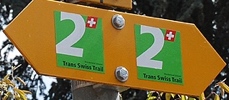
| What: | Trans Swiss Trail – Stage 3 Soubey to Saignelégier Yellow trail markers – Trans Swiss Trail Route 2 |
| Skill: | Medium – About 4 hrs Length 12 km, Ascent 800 m, Descent 280 m |
| Stage 1 – Porrentruy to St-Ursanne Stage 2 – St-Ursanne to Soubey Stage 3 – Soubey to Saignelégier Stage 4 – Saignelégier to St-Imier Stage 5 – St-Imier to Chézard-St-Martin Stage 6 – Chézard-St-Martin to Neuchâtel Stage 7 – Neuchâtel to Murten Stage 8 – Murten to Laupen Stage 9 – Laupen to Bern Stage 10 – Bern to Worb Stage 11 – Worb to Lützelflüh Stage 12 – Lützelflüh to Langnau i.E. Stage 13 – Langnau i.E. to Eggiwil Stage 14 – Eggiwil to Schangnau Stage 15 – Schangnau to Sörenberg Stage 16 – Sörenberg to Giswil Stage 17 – Giswil to Flüeli-Ranft Stage18 – Flüeli-Ranft to Stans Stage 19 – Stans to Seelisberg Stage 20 – Seelisberg to Erstfeld Stage 21 – Erstfeld to Wassen Stage 22 – Wassen to Andermatt Stage 23 – Andermatt to Passo del San Gottardo Stage 24 – Passo del San Gottardo to Airolo Stage 25 – Airolo to Osco Stage 26 – Osco to Anzonico Stage 27 – Anzonico to Biasca Stage 28 – Biasca to Bellinzona Stage 29 – Bellinzona to Tesserete Stage 30 – Tesserete to Lugano (Comano) Stage 31 – Lugano (Paradiso) to Morcote Stage 32 – Morcote to Mendriso |
Getting There
The Trans Swiss Trail is best done with public transportation as each stage starts and ends at different points. Stage 3 starts at Soubey, Village. After getting off the bus, we crossed the bridge and we were right back where we were when we left stage 2.
The Trail – Along the River
The first part of the trail follows along the river, but then quickly takes a detour into the forest and over a hill. This detour away from the river gave us a nice view of some of the rock formations from above, and soon enough we were back down by the river side.
The trail then continued along the river side, passing through a small village and though fields and forest. This part of the trail was very pleasant, easy, walking.
The Trail – From the River up to Saignelégier
Just past the buildings in the first picture, the trail leaves the river behind and begins the steep climb up towards Saignelégier.
Following a small ravine, the trail was often very steep and muddy. We were glad we had our hiking poles with us. There were some interesting rock formations here, and we took a break to have our picnic lunch under the overhang in the first picture below.
After completing about half of the altitude climb, the trail exited the forest, and we took a look back to enjoy the view.
After passing the clearing, the trail continued up through the forest. As we continued to gain altitude, we began to see there was still snow on the ground (mid-April). When the trail joined with a road, it began a very mild descent.
The trail left the road briefly to pass though a field, before again joining the road in the small town of Les Pomerats. There, we followed a paved path up and out of town.
On this part of the trail, we had to watch carefully for the yellow markers as the trail rather abruptly left the paved path and headed across a field where the ground didn’t show a distinct trail to follow.
When we reached the high point of the hike, (the picture above), we could see our destination (Saignelégier) below. Then, it was just a short hike down a paved road to Saignelégier.
Getting Back
After we reached Saignelégier, we followed the signs to the train station. I usually take a picture of the train station sign, but this time I forgot. The last picture here is of the church across the street from the train station.
We’ll be back for the start of stage 4, so I’ll be sure to document the train station in that photo story.


Leave a Reply