Hiking the Trans Swiss Trail – Stage 2 St-Ursanne to Soubey
Spring has officially come, and with its arrival came some fabulous weather. To make the most of it, we decided to continue our hike-through of the Trans Swiss Trail (Route 2) and hike stage 2. This stage starts in the lovely medieval town of St-Ursanne and follows along the Doubs river going up-stream to the tiny village of Soubey. This was a very peaceful, relaxing, and pretty hike, and we enjoyed it very much.

| Where: | St-Ursanne to Soubey Canton Jura, Switzerland |
| Train/Bus: | Zürich HB -> St-Ursanne – 2 hrs 7 min Soubey, Village – > Zürich HB – 2 hrs 58 min Note: Limited bus service from Soubey. Check schedule carefully before heading out. |
| What: | Trans Swiss Trail – Stage 2 St-Ursanne to Soubey Yellow trail markers – Trans Swiss Trail Route 2 |
| Skill: | Easy – About 3 hrs 50 min Length 17 km, Ascent 260 m, Descent 220 m |
| Stage 1 – Porrentruy to St-Ursanne Stage 2 – St-Ursanne to Soubey Stage 3 – Soubey to Saignelégier Stage 4 – Saignelégier to St-Imier Stage 5 – St-Imier to Chézard-St-Martin Stage 6 – Chézard-St-Martin to Neuchâtel Stage 7 – Neuchâtel to Murten Stage 8 – Murten to Laupen Stage 9 – Laupen to Bern Stage 10 – Bern to Worb Stage 11 – Worb to Lützelflüh Stage 12 – Lützelflüh to Langnau i.E. Stage 13 – Langnau i.E. to Eggiwil Stage 14 – Eggiwil to Schangnau Stage 15 – Schangnau to Sörenberg Stage 16 – Sörenberg to Giswil Stage 17 – Giswil to Flüeli-Ranft Stage18 – Flüeli-Ranft to Stans Stage 19 – Stans to Seelisberg Stage 20 – Seelisberg to Erstfeld Stage 21 – Erstfeld to Wassen Stage 22 – Wassen to Andermatt Stage 23 – Andermatt to Passo del San Gottardo Stage 24 – Passo del San Gottardo to Airolo Stage 25 – Airolo to Osco Stage 26 – Osco to Anzonico Stage 27 – Anzonico to Biasca Stage 28 – Biasca to Bellinzona Stage 29 – Bellinzona to Tesserete Stage 30 – Tesserete to Lugano (Comano) Stage 31 – Lugano (Paradiso) to Morcote Stage 32 – Morcote to Mendriso |
Getting There
The Trans Swiss Trail is best done with public transportation as each stage starts and ends at different points. Stage 2 starts at St-Ursanne. After getting off the train, it is about a 10 minute walk down a cobblestone street to one of three gates into the walled town of St-Ursanne (Jura Tourism Site.)
Right now, because of Coronavirus, most places are closed. In addition, the town is refurbishing many of the cobblestone streets, so there was quite a bit of construction going on when we walked though. Not as pretty as one would hope, but I’m sure it will look wonderful when complete.
The Trail
After reaching the center of the village, we were at the fountain where we ended stage 1. A bit of a meander later, we exited though one of the village gates and crossed the Doubs river over the Bridge of St-Jean. St-Jean is the patron saint of bridges and a statue of him stands at the center of the bridge.
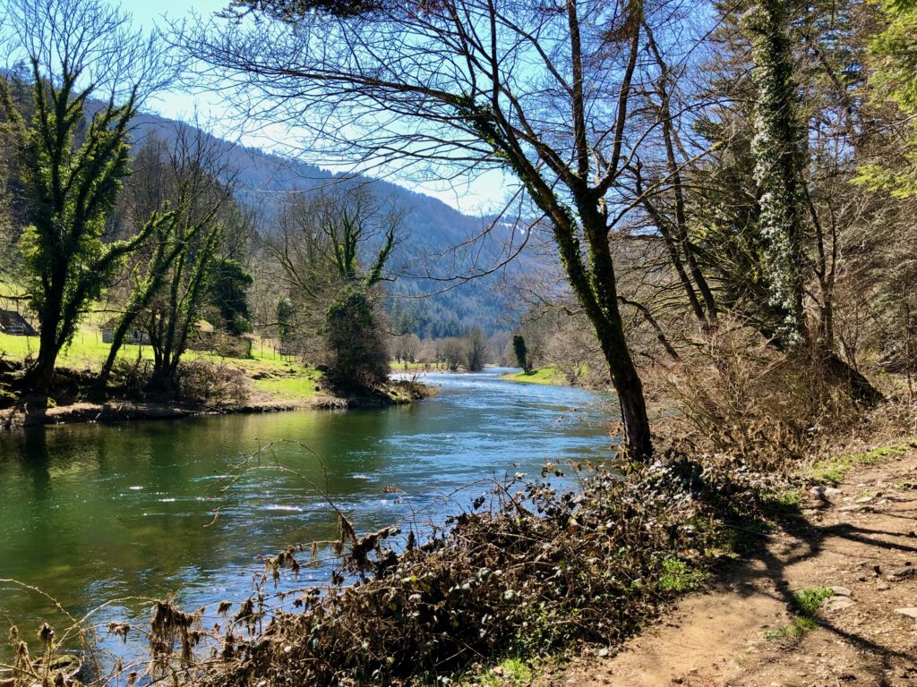
Now on the other side of the river, the trail simply the follows along the river bank going up-stream towards Soubey. In general, this trail is easy walking as it passes through fields, pastures, and forest never too far from the water.
As we hiked, we spotted spring flowers that were just beginning to bloom, and many little butterflies hovering about. A little less than half way, we came across the cables for the Tariche ferry (the cables are visible in the second picture below). The ferry was temporarily closed, but when it is running you can take it across the river to a restaurant (german/french) on the other side. Their patio looked like a lovely place to have lunch. Speaking of lunch spots, there were also quite a few places along the way to stop for a picnic, complete with fire pits and tables. As we continued our walk, we were surprised by just how much moss was growing on some of the trees along the river bank. The moss was very pretty and had a fairy-land quality to it, as did a tiny tributary stream we saw flowing into the river.
As the trail continued, it passed some wide open fields. It felt wonderful to be surrounded by so much green. I tried my best to capture it, but I’m not sure this picture does it justice.
While the trail sticks close to the river for the most part, it does swerve away towards some farms near the end of the hike. One of the farms we passed had a sign up saying they sell fromage. I am doing Duolingo french (Duolingo helped me a lot with german) and lucky for me, one of the french words I’ve learned is fromage (cheese). Of course we had to buy some, and despite our poor french, we managed to do so. A little further along, we passed another farm that had a self-service kiosk. There we bought some caraway crackers that were absolutely delicious! (Pro tip! Always carry some cash/coins with you when hiking in Switzerland. These little self-service farm kiosks are everywhere.) And a little later, we passed a salmon farm. No salmon for sale. Although, I’m pretty sure we would not have bought any even if there was.
Not long after passing the salmon farm, the village of Soubey was in sight.
Getting Back
Just over the bridge is the Soubey village bus stop and the end of stage 2. And, well, we really could have planned our return trip better. When we arrived, there was a two hour wait for the next bus. There are a couple of stores and restaurants in Soubey, but all of them were closed (Coronavirus restrictions), so there wasn’t much for us to do besides wait.
If I were to hike this section again, I think I would do it in reverse – start in Soubey and end in St-Ursanne. For the next stage, we’ll be taking one of the two morning busses to Soubey. Looking forward to it and hoping that it works out.


Leave a Reply