Hiking the Trans Swiss Trail – Stage 14 Eggiwil to Schangnau

Stage 14 of the Trans Swiss trail is 13 km and goes from Eggiwil to Schangnau. With 800 m of ascent and 600 m of descent, it is a solid hike. Fortunately, it is also a hike with views worth the work. I wasn’t sure that would be the case when we headed out for the trail in the morning as we were completely fogged in. And while the fog lingered at the lower elevations, up on the trail, we had wonderful clear skies for the entire hike allowing us to enjoy the spectacular views.

| Where: | Eggiwil to Schangnau Canton Bern, Switzerland |
| Train/Bus: | Zürich HB -> Eggiwil – 2 hr 7 min Schangnau -> Zürich HB – 1 hr 56 min |
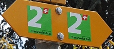
| What: | Trans Swiss Trail – Stage 14 Eggiwil to Schangnau Yellow trail markers – Trans Swiss Trail Route 2 |
| Skill: | Medium – About 4 hrs 20 min Length 13 km, Ascent 800 m, Descent 600 m |
| Stage 1 – Porrentruy to St-Ursanne Stage 2 – St-Ursanne to Soubey Stage 3 – Soubey to Saignelégier Stage 4 – Saignelégier to St-Imier Stage 5 – St-Imier to Chézard-St-Martin Stage 6 – Chézard-St-Martin to Neuchâtel Stage 7 – Neuchâtel to Murten Stage 8 – Murten to Laupen Stage 9 – Laupen to Bern Stage 10 – Bern to Worb Stage 11 – Worb to Lützelflüh Stage 12 – Lützelflüh to Langnau i.E. Stage 13 – Langnau i.E. to Eggiwil Stage 14 – Eggiwil to Schangnau Stage 15 – Schangnau to Sörenberg Stage 16 – Sörenberg to Giswil Stage 17 – Giswil to Flüeli-Ranft Stage18 – Flüeli-Ranft to Stans Stage 19 – Stans to Seelisberg Stage 20 – Seelisberg to Erstfeld Stage 21 – Erstfeld to Wassen Stage 22 – Wassen to Andermatt Stage 23 – Andermatt to Passo del San Gottardo Stage 24 – Passo del San Gottardo to Airolo Stage 25 – Airolo to Osco Stage 26 – Osco to Anzonico Stage 27 – Anzonico to Biasca Stage 28 – Biasca to Bellinzona Stage 29 – Bellinzona to Tesserete Stage 30 – Tesserete to Lugano (Comano) Stage 31 – Lugano (Paradiso) to Morcote Stage 32 – Morcote to Mendriso |
Getting There
The Trans Swiss Trail is best done with public transportation as each stage starts and ends at different points. Stage 14 picks right up where stage 13 left off in the Eggiwil. From the Eggiwil, Dorf bus stop it is a short walk back to the Emme river and the beginning of our next section of the trail.


The Trail
The trail begins by briefly following along the Emme river. After about a kilometer or so, the trail heads into the woods where some parts of the trail were rather steep (we regretted not bringing our hiking poles with us). But once we left the forest, the ascent became more gradual and we also started to get some fantastic views.


As we walked along, the unevenness of the land here was very striking. I really enjoyed this section of the trail.


I thought that our lunch spot was the highpoint of the hike, but no, we still had some more ascent to go.


When we did reach the highpoint, the views were spectacular! And, there was a bench for a bit of a rest. This spot is at the confluence of several trails, and on a gorgeous day like this one, it was a fairly busy place.


It was now time to begin the hike down. We hiked this part slowly as it was a bit steep. Also, we kept stopping to admire the view.


After we entered the forest, the trail was a bit tricky to walk on as it was very steep and had lots of loose, rolling, round rocks. This was not my favorite part of the hike.


I was happy to be out of the forest and to see the town of Schangnau below. The trail description had said that Schangnau was famous for its mozzarella and that there would be black buffalo visible on the descent. We were disappointed that we didn’t see them or see anywhere to buy cheese. Oh well.
Getting Back
Schangnau isn’t a very large town, so almost as soon as we reached it, we were at our bus stop.


.


Leave a Reply