
Category: Hiking
All hiking routes are in Switzerland unless otherwise specified in the title of the post.
-

The Speer Summit Loop hike from Amden is a 15 km hike with 700 M of ascent and 900m of descent.
-

The trail from Pizolhütte to Weisstannen, Oberdorf is 12 km long with 368 m of ascent and 1594 m of descent that passes through the Batöni Waterfall Arena. We also added a short scramble up to the Hochwart peak.
-

The Ybriger 7-Egg-Weg is 11 km long and starts at the top of the Sternen chair lift in Hoch Ybrig and ends at the top of the Brunni, Holzegg cable car.
-

Stage 32 of the Trans Swiss trail is 12 km long with 860 m ascent and 800 m descent and goes from Morcote to Mendriso (including a ferry ride from Morcote to Brusino Arsizio, Funivia).
-

Stage 31 of the Trans Swiss trail is 12 km long with 840 m ascent and 880 m descent and goes from Lugano (Paradiso) to Morcote. This was one of prettiest hikes of the entire Trans Swiss Trail with some absolutely stunning views from the top of Monte San Salvatore.
-

The Senda Ruinaulta is a 10 km, 360 ascent/descent loop trail easily accessed from the Laax, Staderas bus stop.
-

While at Saxon Switzerland National Park in Germany, we hiked to the Bastei Bridge and through the Swedish Holes, about 6 km with 215 m ascent/descent.
-
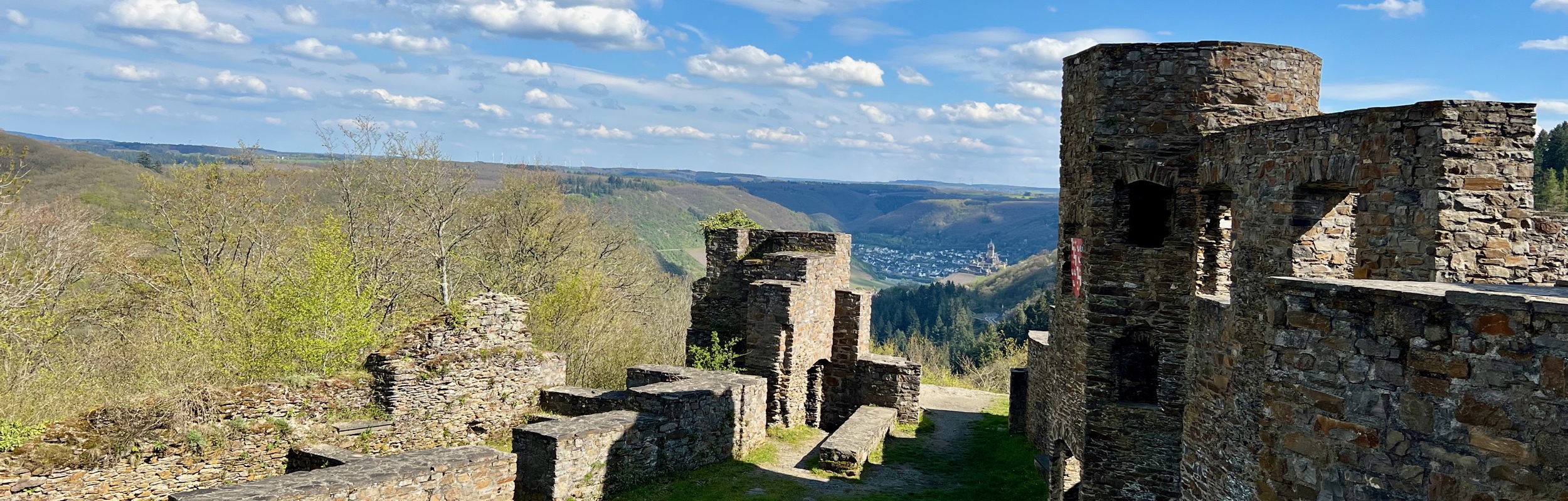
While in the Mosel Valley in Germany, we stayed in the town of Cochem, and did a loop hike from there up to the ruins of Winneburg castle.
-

Stage 30 of the Trans Swiss trail is 5 km long with 220 m ascent and 220 m descent and goes from Tessereste to Lugano (Comano).
-

Stage 29 of the Trans Swiss trail is 24 km long with 1400 m ascent and 1100 m descent and goes from Bellinzona to Tesserete. We did this as a two day hike with an overnight in Isone.
-

The Mülitobel-Sihl-Weg trial is 14km long with 250 m ascent and 560 descent and goes from Shönenberg (ZH) to Richterswil.
-

Stage 28 of the Trans Swiss trail is 25 km long with 120 m ascent and 170 m descent and goes from Biasca to Bellinzona.