
Category: Hiking
All hiking routes are in Switzerland unless otherwise specified in the title of the post.
-

Stage 27 of the Trans Swiss trail is 18 km long with 440 m ascent and 1150 m descent and goes from Anzonico to Biasca.
-

The Rundweg Winterthur trail is a 10 stage, 70 km loop trail that follows along the Winterthur city limits. For our hike, we only did the 15 km long section recommended on the SwissMobility website that went from the Kempttahl train station to the bus stop in Elsau, Tolhusen.
-

For our last hike of 2022, we decided to do something close by and headed up to the Horgenberg for an easy loop around the fields to Hirzel and then back along the ridge past Hirzel Höhi. This isn’t an “official” hiking route, but I decided to write a post about it anyway.
-

Stage 26 of the Trans Swiss trail is 12 km long with 600 m ascent and 740 m descent and goes from Osco to Anzonico.
-

Stage 25 of the Trans Swiss trail is 18 km long with 760 m ascent and 760 m descent and goes from Airolo to Osco.
-

The Mythenweg trail is a short (6 km) but demanding (660 m of ascent and descent) trail that takes you from the top of the Rotenflue gondola to the top of the Grosser Mythen Peak and then back again.
-

Stage 24 of the Trans Swiss trail is 7 km long with 20 m ascent and 950 m descent and goes from Passo del San Gottardo (top of the Gotthard Pass) to Airolo.
-

Stage 23 of the Trans Swiss trail is 13 km long with 720 m ascent and 120 m descent and goes from Andermatt to Passo del San Gottardo (top of the Gotthard Pass).
-
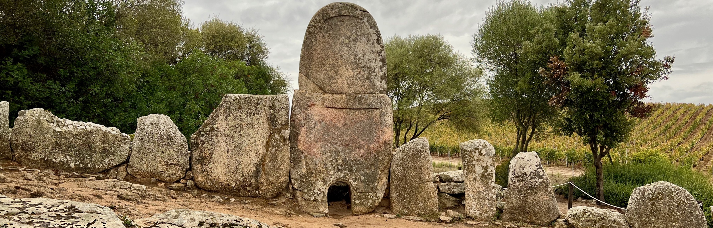
On our trip to Sardinia, we spent an afternoon near the town of Arzachena visiting three archeological sites from the Nuraghic civilization, the civilization/culture that existed on Sardinia from roughly the 18th century BC to 238 BC when Sardinia was colonized by the Romans.
-
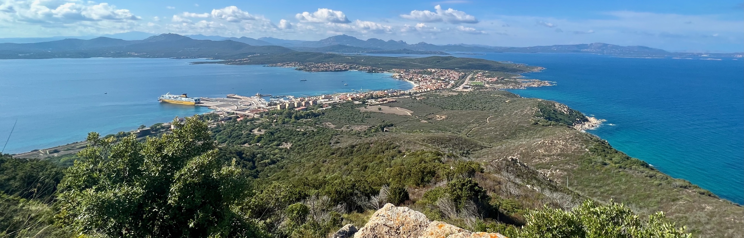
On a recent trip to Sardinia, Italy, we spent a very lovely afternoon hiking in Capo Figari Nature Park by Golfo Aranci. We did a loop comprised of the Carbonai, Mount Ruju, and Su Canale trails, and the road Via Cala Moresca.
-

Stage 22 of the Trans Swiss trail is 10 km long with 680 m ascent and 150 m descent and goes from Wassen to Andermatt. Along the way, the Schöllenenschlucht gorge and the Teufelsbrücke (Devil’s Bridge) were particularly dramatic.
-

Stage 21 of the Trans Swiss trail is 19 km long with 1000 m ascent and 540 m descent and goes from Erstfeld to Wassen.