
Category: Point-To-Point Hike
Hiking routes that start and end at different locations. All routes are in Switzerland unless otherwise specified in the title of the post.
-

Stage 13 of the Trans Swiss trail is 12 km and goes from Langnau i.E. to Eggiwil. With 600 m of ascent and 540 m of descent, it is a solid hike.
-
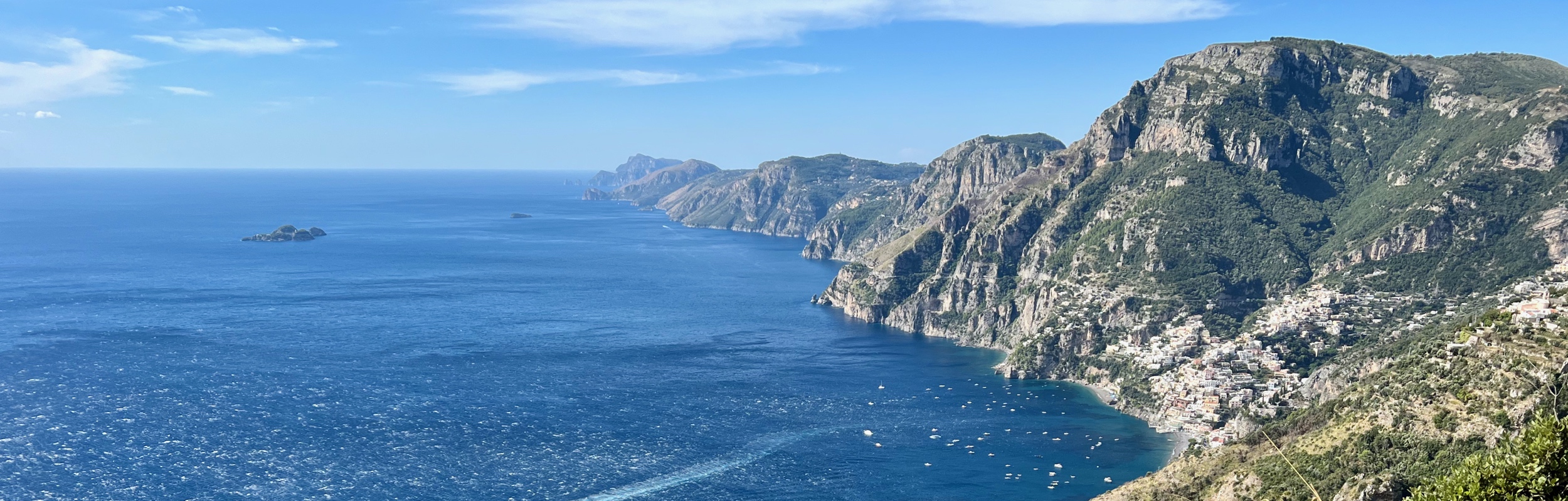
While in Sorrento, Italy, we hiked the “Sentiero Degli Dei” or the “Path of the Gods” – a 6 kilometer trail along the Amalfi coast starting in Agerola and ending in Nocelle. From Nocelle, we walked an additional 3 kilometers to end our hike in the gorgeous seaside town of Positano.
-

Stage 12 of the Trans Swiss trail goes from Lützelflüh to Langnau i.E. and is a relatively easy stage at 13 km and only 150 m ascent and 60 m.
-

Stage 11 of the Trans Swiss trail is an 18 km hike (with 640 m ascent and 640 m descent) going from Worb to Lützelflüh.
-

Stage 10 of the Trans Swiss trail is a 16 km hike (with 300 m ascent and 240 m descent) going from Bern to Worb.
-

At 25 km, stage 9 of the Trans Swiss trail is a long hike (the “official” hike is 22 km, but then it is another 3 km to walk to the train station). Fortunately, with only 400 m ascent and 360 m descent, it isn’t a very difficult hike.
-

The Gemmipass is a historic mountain passage connecting Canton Valais and Canton Bern, which, has been used since ancient times (coins from the Roman empire have been found here). The hike is about 8.5 km with about 80 m of ascent and 480 m of decent along well maintained gravel paths.
-

Stage 8 of the Trans Swiss trail is a 15 km long hike with 280 m of ascent and 250 m of descent. The trail goes from Murten to Laupen and it is a fairly easy walk through fields, forest, and small towns.
-

The hike between Monte Tamaro and Monte Lema is an absolutely spectacular trail with stunning views the entire way. At about 13 km and 753 m ascent and 717 m decent, (without the optional peak climbs) it isn’t easy and it takes a bit of planning to do.
-

Stage 7 of the Trans Swiss trail is a 19 km long hike with a 360 m ascent and a decent of 340 m. The trail technically goes from Neuchâtel to Murten, but as you cross Lake Neuchâtel with the ferry, you don’t actually start hiking until you reach Cudrefin.
-

Stage 6 of the Trans Swiss trail is an 11 km long hike with a 200 m ascent and a decent of 560 m.
-

In our hike-through of the Trans Swiss Trail, we are on to stage 5, a 15 km stretch with an ascent of 580 m and descent of 560 m that goes from St-Imier to Chézard-St-Martin.