Hiking the Monte Tamaro – Monte Lema Traverse
When googling for best hikes in Ticino, I think I saw the hike between Monte Tamaro and Monte Lema on just about every list I found, and after hiking it myself, I am in no way surprised. This is an absolutely spectacular trail with stunning views the entire way. That said, at about 13 km and 753 m ascent and 717 m decent, (without the optional peak climbs) it isn’t easy and it takes a bit of planning to do.
Detail Summary| Where: | Monte Tamaro to Monte Lema Canton Ticino, Switzerland |
| Train/Bus: | Zürich HB -> Rivera-Bironico 2 hrs 18 min. You then have a 10 minute walk to the Monte Tamaro gondola station. Miglieglia, Funivia Monte Lema (Parkplatz) -> Zürich HB – 3 hrs |
| What: | Monte Tamaro and Monte Lema Traverse Yellow trail markers Tamaro Capanno -> Monte Lema Note: As you hike, the path will branch at a couple of locations with signs pointing to Monte Lema in two directions. One path bypasses the summit and the other takes you over the summit. If you are not sure which is which, there are time estimates listed on the trail markers. The shorter time will be the easier trail. |
| Skill: | Difficult – About 5 hrs Length 13 km, Ascent 753 m, Descent 717 m Note: The additional elevation change and time to go over the optional summits are not included in the estimate. If you intend to do all the summits, I suggest adding at least another hour to the estimated time. |
| Schedule and Cost | Generally open June to the end of October. Last possible ride with cablecar usually 4:45 pm. See the Monte Tamaro and Monte Lema websites for current conditions, gondola prices, and operating hours. |
- Bring hiking sticks – The trail is a T2 red-and-white mountain trail so not the most technically difficult, but I definitely recommend bringing hiking sticks for this one – there are steep drop offs and areas with loose rock making footing tricky at times.
- Bring plenty of water and sun protection – The sun can be quite relentless as there is very little shade along the way. There are also no services along the way, so you need to be sure to pack plenty of water.
- Important! Keep an eye on the clock – The tourist map that we picked up at the Monte Tamaro gondola station lists this hike as “12.6 k, with 421 m of elevation change, excluding paths over summits. Duration: 4.5 – 5 hours.” As you hike, the path will branch at a couple of locations with signs pointing to Monte Lema in two directions. One path bypasses the summit and the other takes you over the summit. The additional elevation change and time to go over the summits are not included in the estimate. If you intend to do all the summits, I suggest adding at least another hour to the estimated time. This estimate also does not include the hike from the top of the gondola station at Alpe Foppa up to Capanno Tamaro, which adds an additional 300 or so meters of elevation and another 40 minutes to the total time of the hike. If you plan to do the optional peak, plus take a lunch break, I would make sure to have at least 6.5 hours to get from Alpe Foppe to the gondola station at Monte Lema before the last run (usually at 4:45 pm). If you aren’t at Alpe Foppe before 10 am, I would not start this hike.
- Bus option for returning to your parked car – If you parked a car at the start point, you can purchase a bus ride from Miglieglia (bottom station of the Monte Lema gondola) back to your car, which can save you some time over the public transport option. See the Monte Tamaro website for more information.
| Monte Tamaro and Monte Lema Traverse Monte Tamaro (includes opening hours, current conditions, and prices) Monte Lema (includes opening hours, current conditions, and prices) |
Getting There
The Monte Tamaro gondola station is a short 10 minute walk from the Rivera-Bironico train station. If you are driving, you can park at either the train station or at the Monte Tamaro gondola. As this is a one way hike, you will need to get transportation back from Miglieglia, Funivia Monte Lema (the bottom gondola station at Monte Lema). Public transport options take between an 1 hr and 1.5 hrs. There is a bus offer direct from Monte Lema to Monte Tamaro that can be purchased when getting your gondola ticket. I did not use it as our plan was to take public transport directly back home after the hike. After purchasing our gondola tickets, we quickly made the ascent up to Alpe Foppa and the beginning of our hike.
There is a restaurant with patio at Alpe Foppa as well as a church and scenic overlook. The church, Santa Maria Degli Angeli, was designed by the Swiss architect Mario Botta and contains art work by the Italian painter Enzo Cucchi. It is a beautiful building but sadly none of my pictures captured it well enough to post.
The Trail – Alpe Foppa to Capanno Tamaro
From Alpe Foppe, the trail starts by hiking up to Capanno Tamaro. The first picture shows the view from Alpe Foppa up towards Capanno Tamaro where there is a radio tower. There are several modern art statues along the path here and I really liked the view the statue in the second picture has of Alpe Foppa.
When we reached Capanno Tamaro, there were gorgeous views all around. If you are following the directions on the tourist map found at the Monte Tamaro gondola station, this is where the hike officially starts.
The hut here serves food and drinks, but we did not stop.
The Trail – Capanno Tamaro to Monte Lema
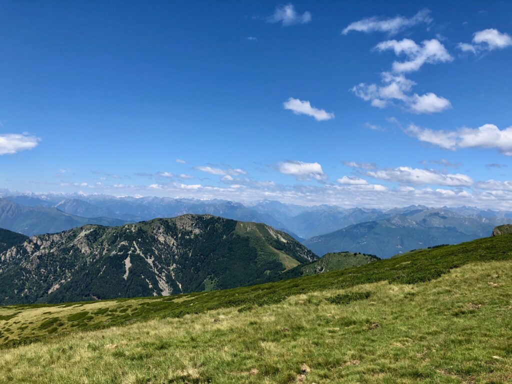
As we continued on the trail towards Monte Lema, the views were spectacular.
An important thing to note about this trail is that the tourist map from the Monte Tamaro gondola station lists this hike as taking 4.5 – 5 hours, but that does not include the optional paths over summits. We initially started up the optional path to the second summit you see in the picture above. As you can see in the first picture below, it is very steep with a lot of slippery loose rock. As we did not have our hiking sticks with us, we decided to turn around and take the trail bypassing the peak (picture three) instead. This trail is also a bike path, so it is a good idea to keep an eye out for mountain bikers here – they can come up behind you quite quickly and there is no room for them to easily go around you.
After the trails rejoined, we looked back up at the trail we did not take (picture 4 above). I think it would have been nice, but we definitely would have wanted our hiking sticks coming down. No real regrets about not taking it though, as the views were fantastic the entire way.
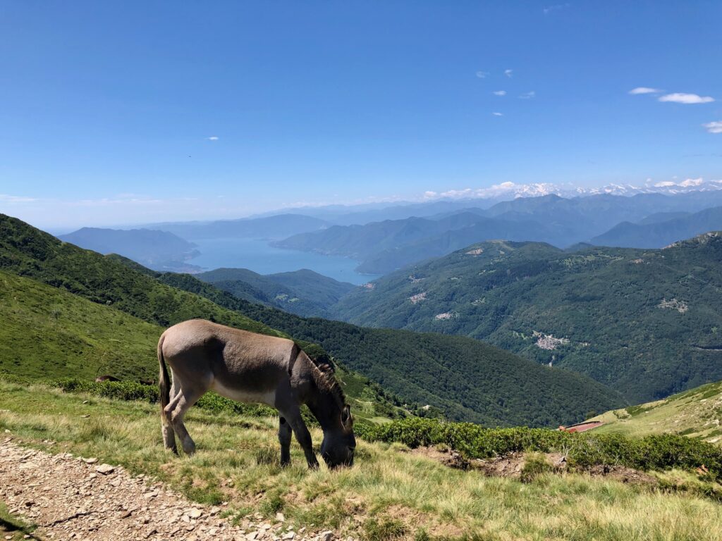
Shortly after we passed the donkey in the photo above we came across the small hut in the first picture below. This self-service kiosk sold cheese and cold drinks. And even though 4 CHF is a lot for a Denner iced tea, I got one anyway. We had forgotten to fill one of our water bottles and were a little less prepared than we should have been.
The above picture was taken at my favorite part of the trail. Not too steep on either side and it had wide-open expansive views in every direction. Absolutely fantastic! Although, as you can see below, there were no bad views on this trail.
After about 5 hours of hiking, the Monte Lema station was in sight.
At Monte Lema, there is a playground and a restaurant (with a much appreciated WC), and, of course, a beautiful view. We had just missed the gondola down so we had a half hour wait until the next one giving us a little time to rest.
Getting Back
After catching the gondola down, we were in Miglieglia.
Too tired to do any exploring, we simply consulted the SBB app for where/when to catch the next bus home. After finding our bus stop (and a water fountain), we rested and waited for the bus. I totally see why this hike is on so many best hikes in Ticino lists. It is absolutely stunning. While it was a bit harder than the tourist map had made it seem, it was definitely worth doing. What a great hike!


Leave a Reply