
This 6 km hike from the top of the Stanserhorn to the small town of Wirzweli has 102 m ascent and 749 m descent. The views on the trail are fantastic, however, the first half of this trail is very steep and there are a lot of steps down which can be hard on the knees – I really appreciated having my hiking poles and shoes for this hike. For the second half of the trail, we took the path through the valley rather than the path along the ridge to Wirzweli as I had originally planned. The route we took was nice, but I think the other route might be better and I plan to go back to hike it some other time. I will update this post with new pictures when I do.
Note: As of 2026, this trail is a great value if you are a GA Card or SwissTravel Pass holder as the funicular and the gondolas on both sides are covered. If you aren’t up for the steep hike, I still recommend going up to the Stanserhorn. There is a restaurant and gorgeous short panorama trail at the top that is worth a visit.
Detail Summary
| Where: | Stanserhorn to Wirzweli Canton Nidwalden, Switzerland |
| Train: | Zürich HB -> Stanserhorn -1 hr 44 mins Wirzwelli – > Zurich HB – 2 hr 11 mins |
| What: | Trail Map of the variant we did of this hike (SwissMobility) Red and White trail markers Stanserhorn -> Gipfel / Summit -> Wirzweli |
| Skill: | Medium- About 2 hrs Length 6 km, Ascent 103 m, Descent 749 m |
| Cost 2026: | Funicular and Gondola to Stanserhorn Free with GA card and SwissPass Full Price Adult One Way: CHF 41 It can be crowded so a time slot reservation for the gondola is recommended and costs CHF 2. Gondola from Wirzweli Free with GA card and SwissPass Full Price Adult One Way: CHF 11.80 From the valley station it is a 15 minute walk to the Dallenwil train station. During the operating hours of the Dallenwil-Wirzweli cable car, there is free shuttle service between the Dallenwil train station and the Wirzweli cable car valley station. To get it you need to call: Tel. +41 41 628 23 94 We didn’t take the shuttle bus so I’m not sure what it is like or if they speak English. |
Additional Info
| Trail Map of the variant we did of this hike (SwissMobility) Trail Map of the variant with the ridge hike I had intended to do (SwissMobility) Stanserhorn Wirzweli (german) |
Getting There
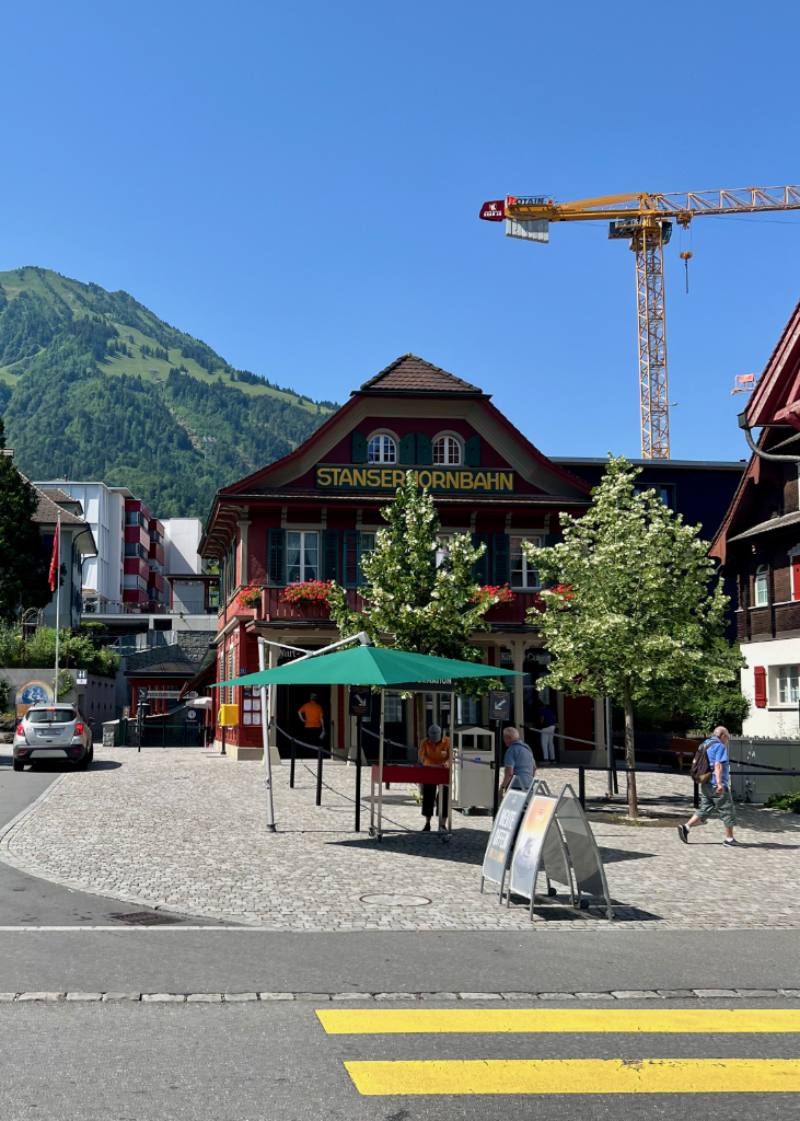
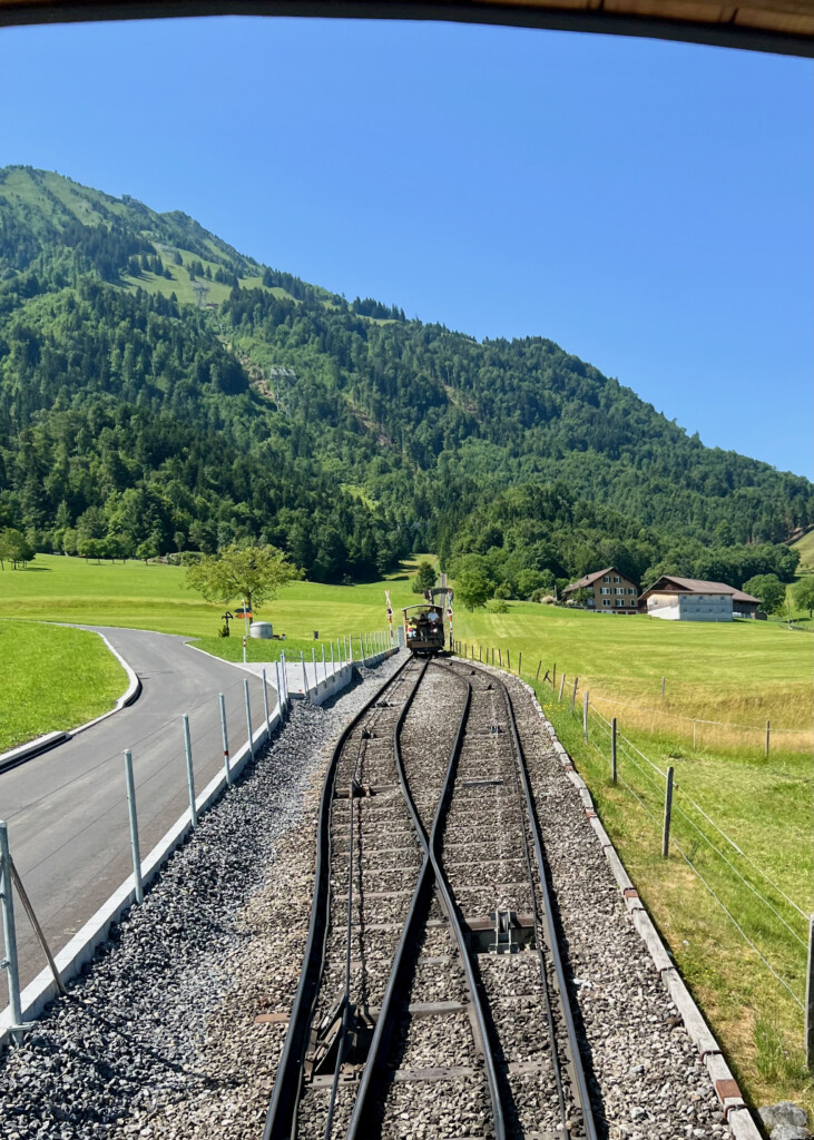
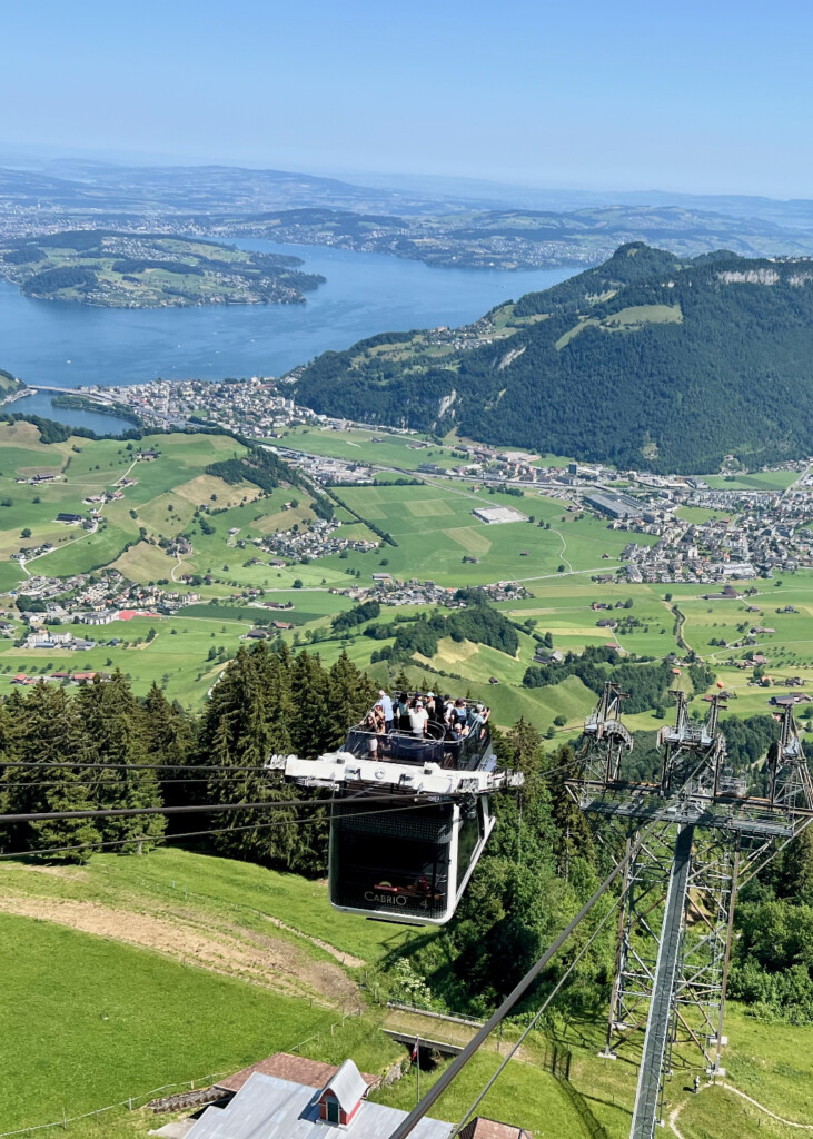
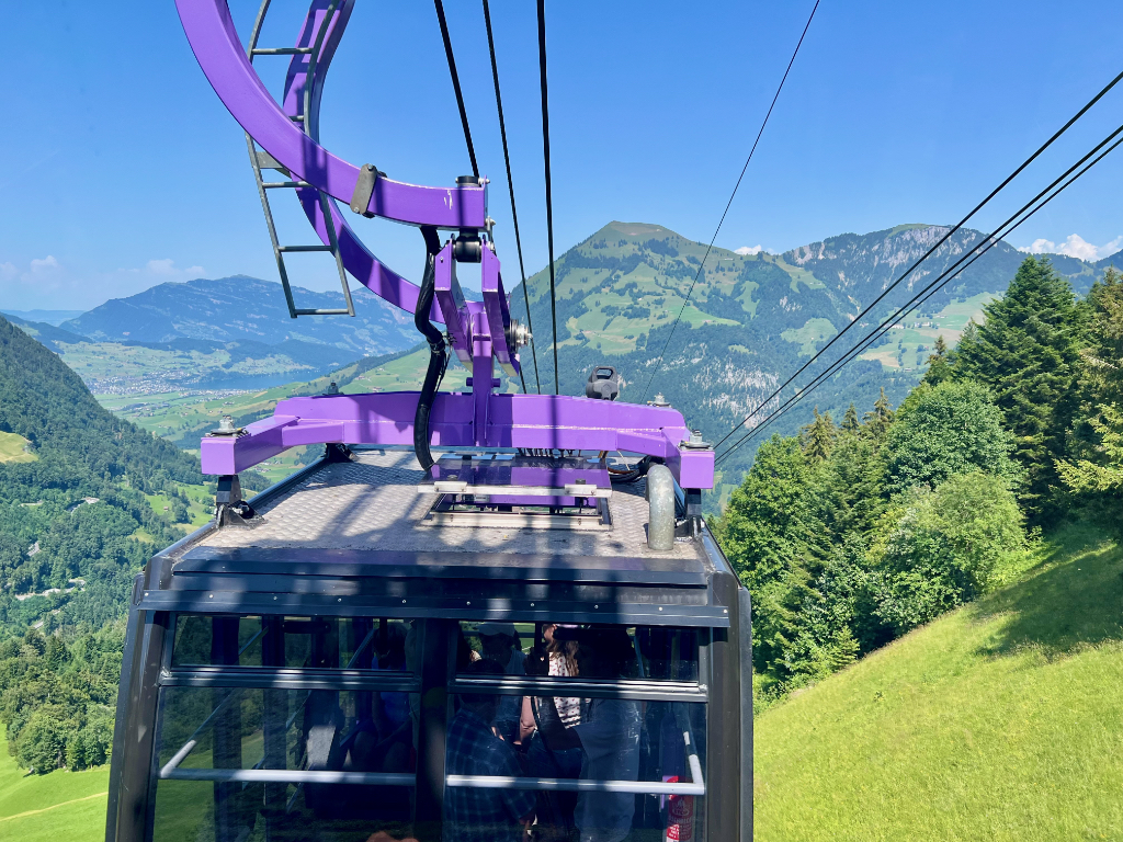
This is a point-to-point hike, so best done with public transportation. This hike starts at the top of the Stanserhorn. To get there, you need to take the Stanserhorn funicular from the valley station in Stans (a short walk from the Stans train station) to the gondola valley station and then take the gondola up to the top of the Stanserhorn. The gondola has two levels and is open at the top so you can get an amazing view as you ride up. Although recommended, we didn’t get a time slot reservation before we went. Fortunately, it wasn’t crowded and we were able to get right on the next funicular.
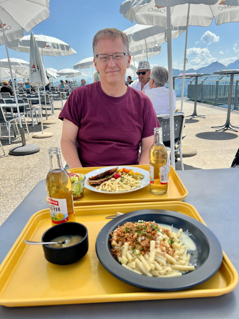
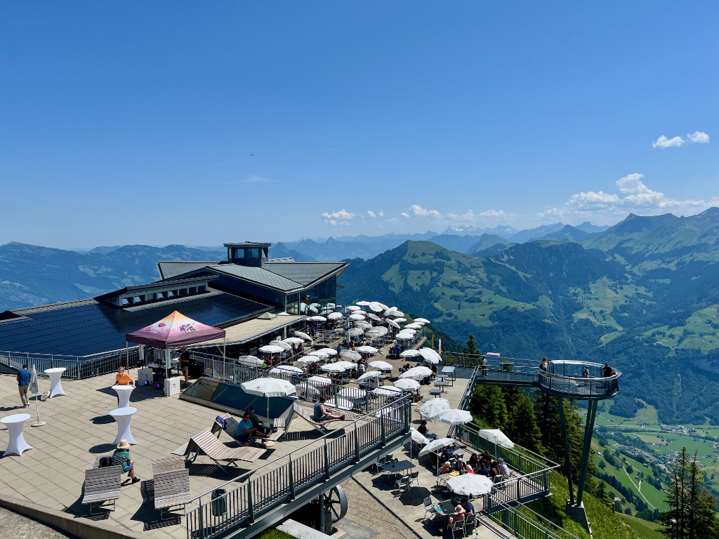
After admiring the views from the viewing platform, we got something to eat at the self-service restaurant. The älplermagronen was ok as was the roast pork my husband got. The food is nothing special but the views certainly make this restaurant worth coming to.
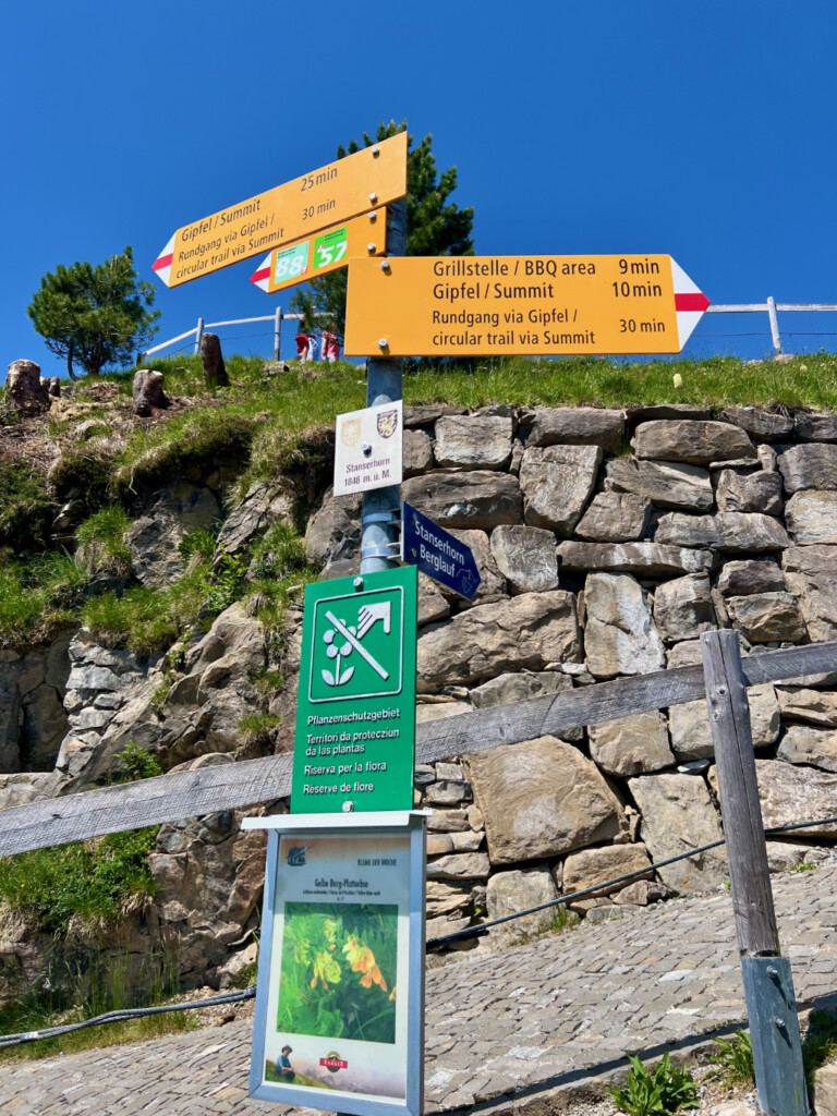
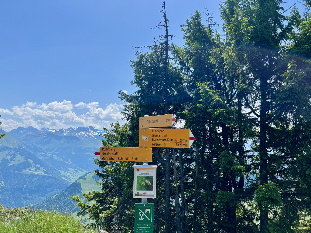
After lunch, we started the hike by following the signs to Gipfel / Summit.
The Trail
This trail started with a short hike (5 to 10 minutes walk maybe) to the peak of the Stanserhorn. On the way up, I snapped a picture of the restaurant and cable car station from above.
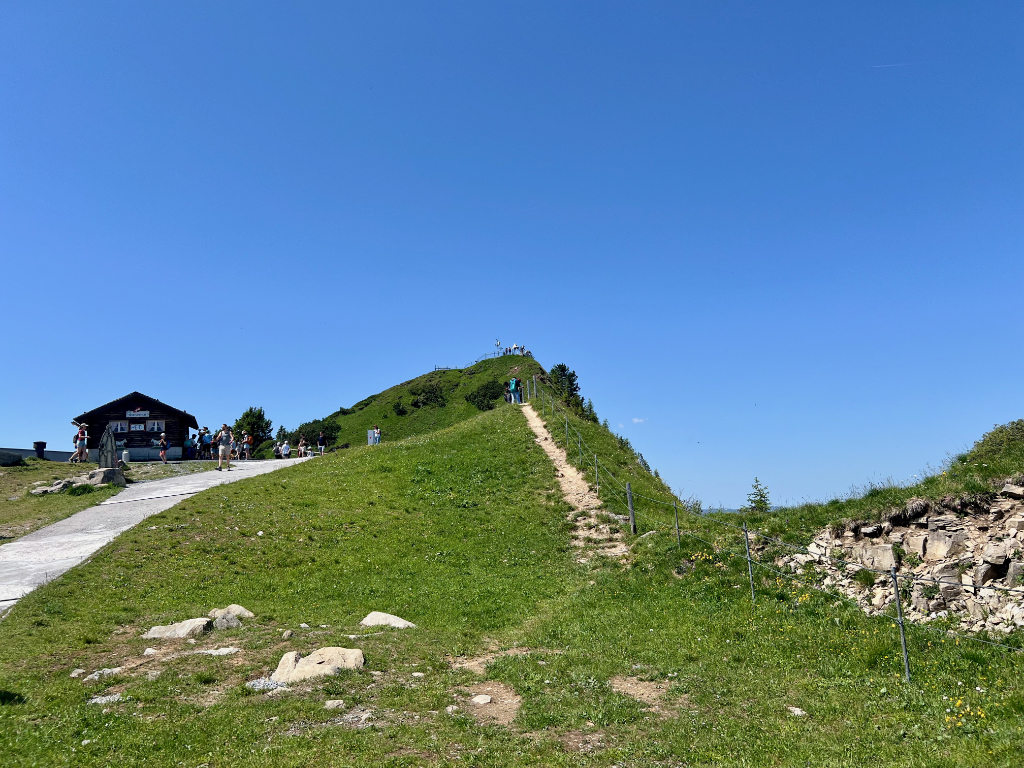
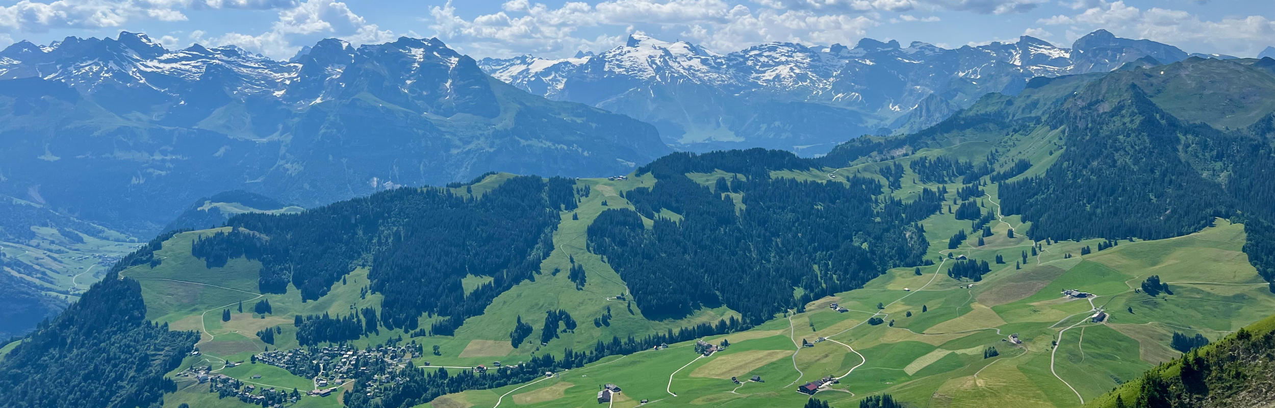
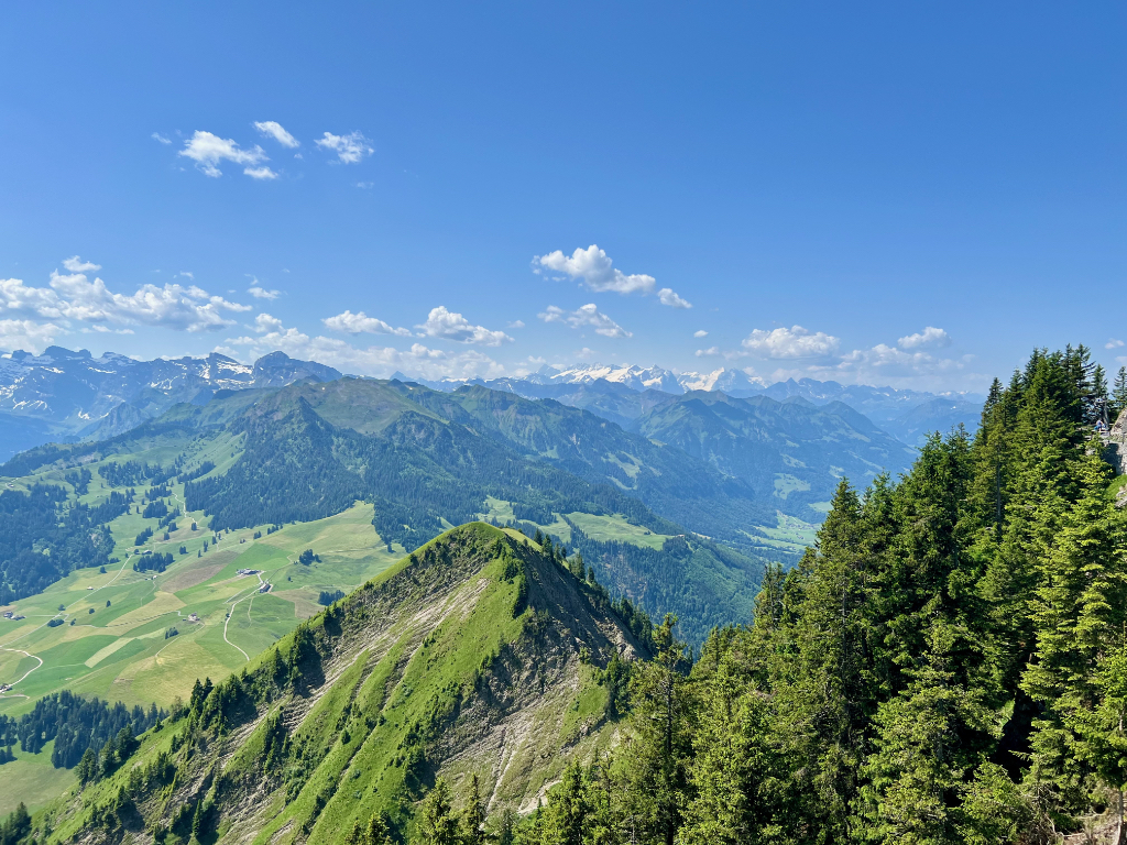
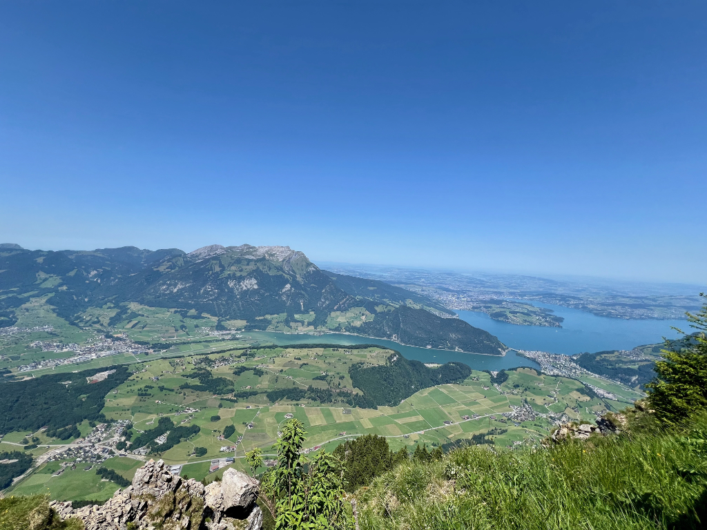
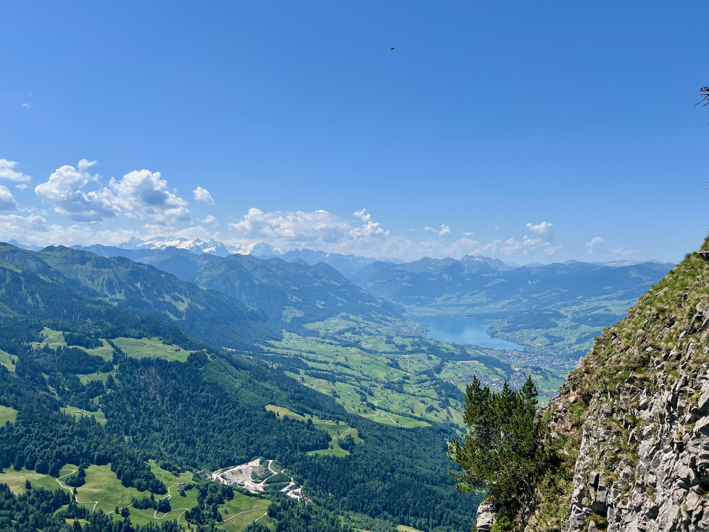
When we reached the top, the panorama views were spectacular!
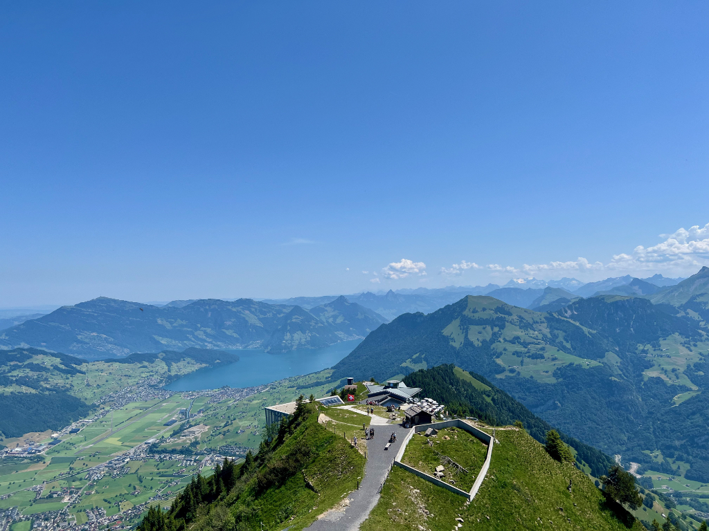
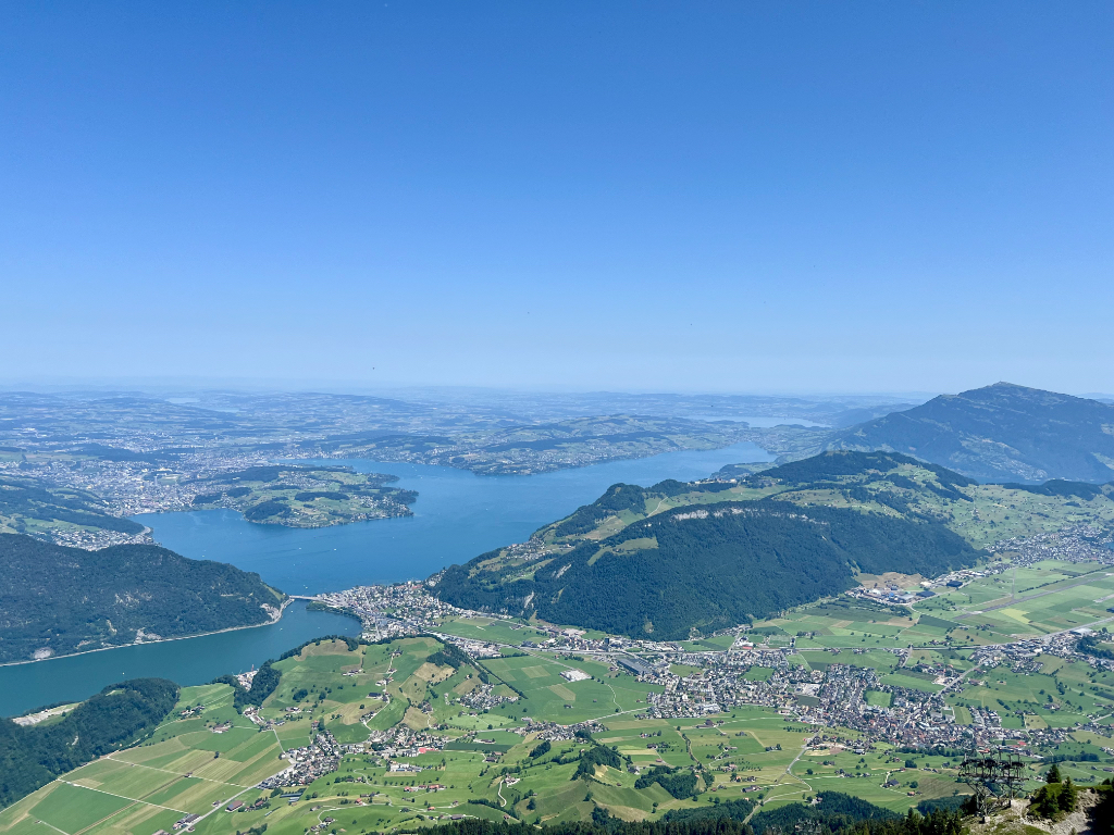
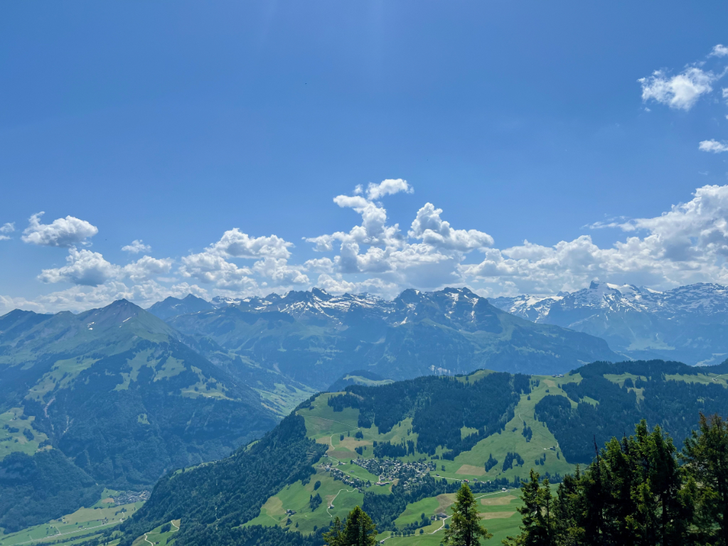
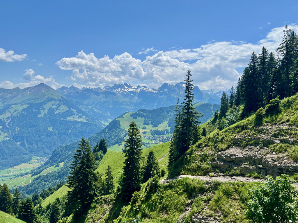
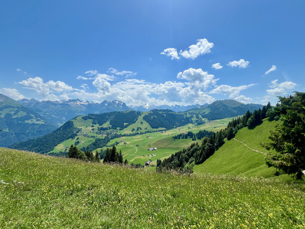
After leaving the summit, we followed the signs to Wirzweli. Lots of great views along the way.
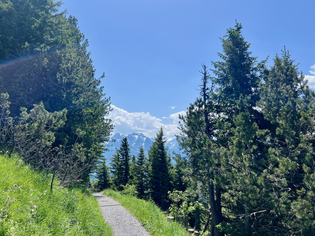
The first kilometer was very steep with a lot of stairs. Fortunately, there were guide cables along the way for safety.
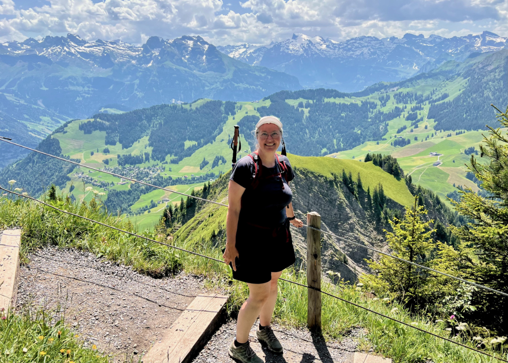
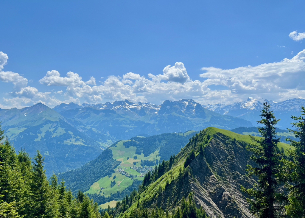
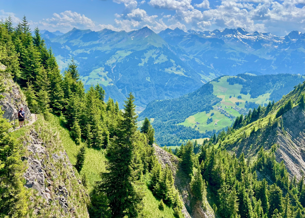
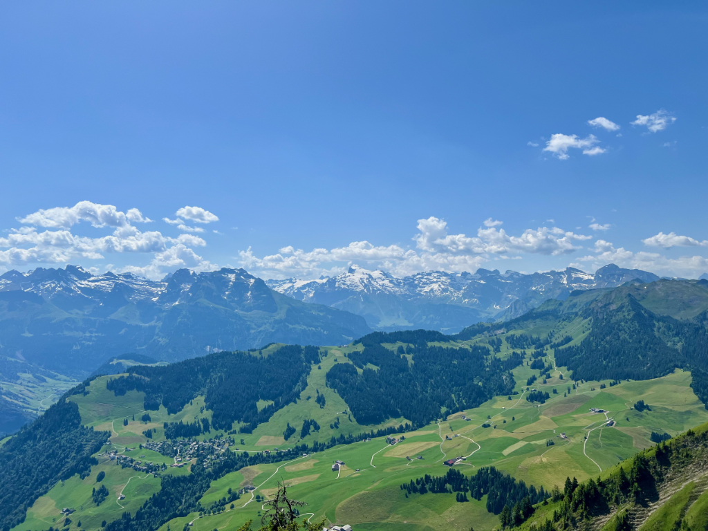
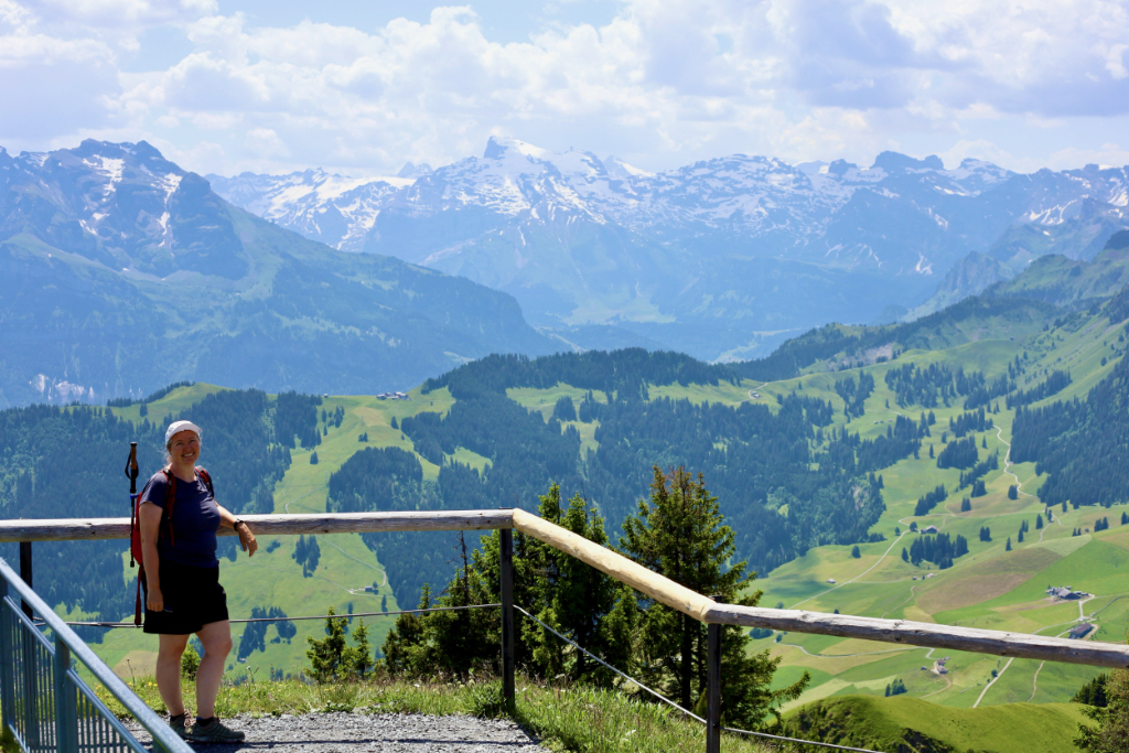
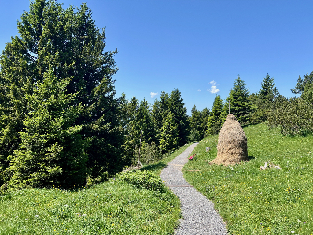
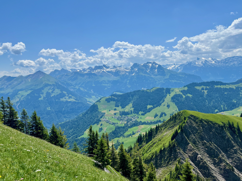
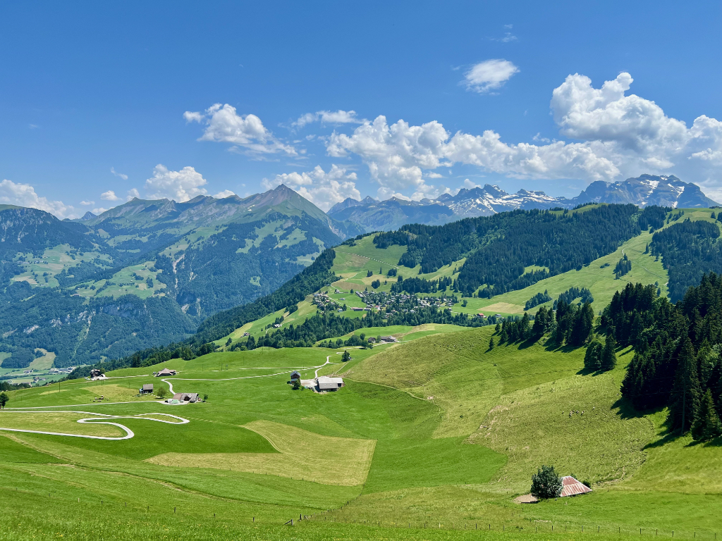
The second kilometer was less steep and there were no longer guide cables, but it was still steep enough that it was nice to have my hiking sticks for balance. In the second picture below, behind my husband, is the ridge we hiked down.
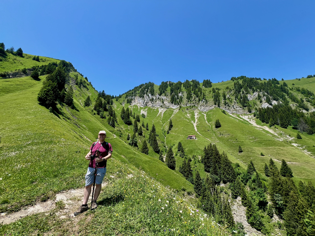
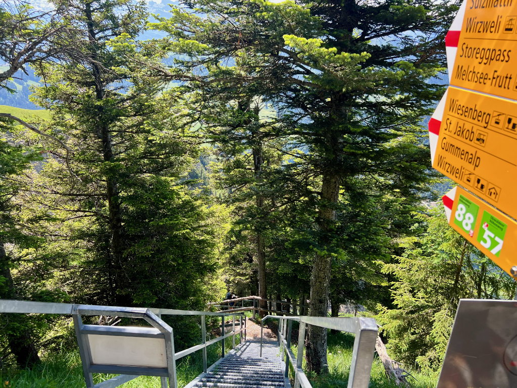
At the farm in the picture above is the trail intersection where we took a wrong turn and ended up hiking through the valley instead of along the ridge. The sharp left goes down into the valley, the soft left goes along the ridge, and the right turn is a short trail spur. Next time, I will take the soft left to the ridge path.
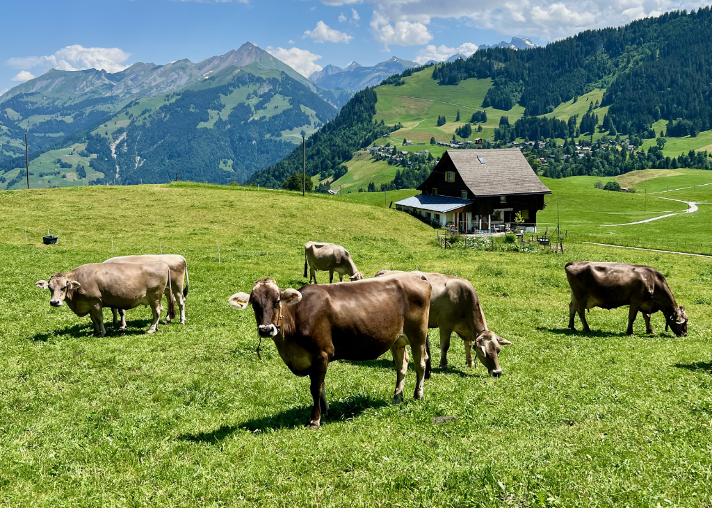
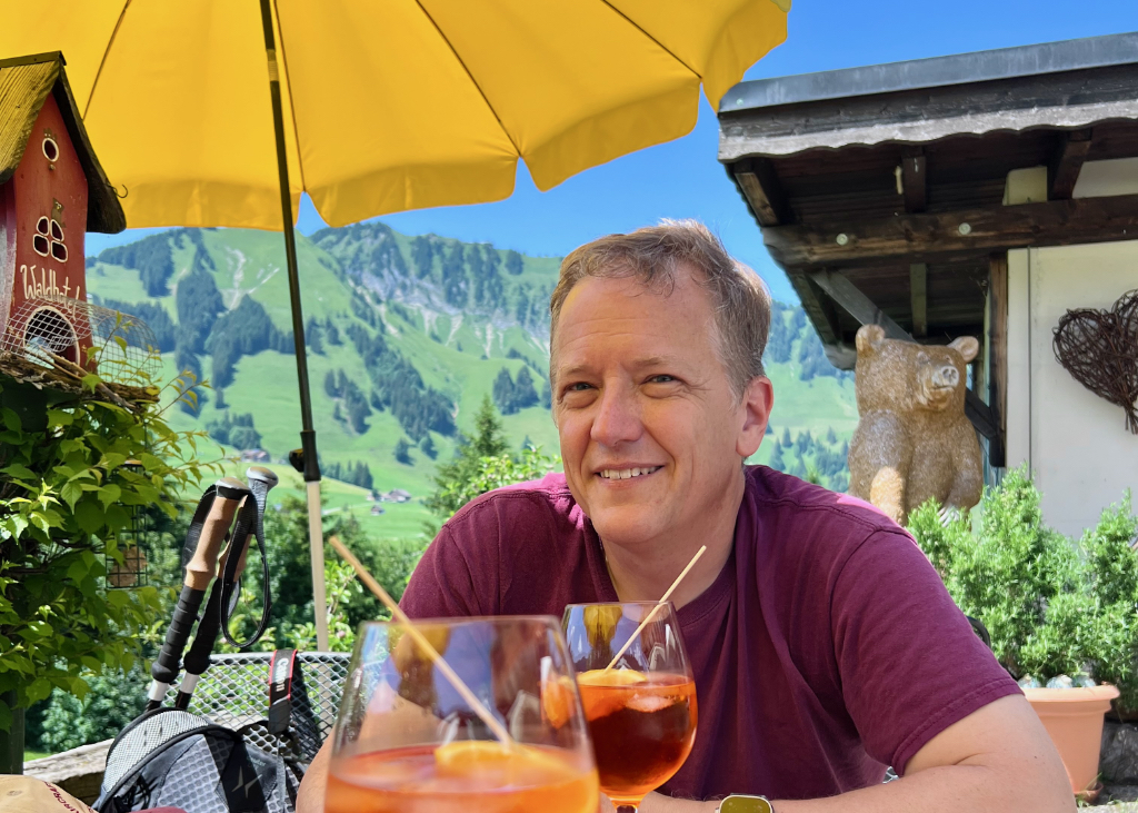
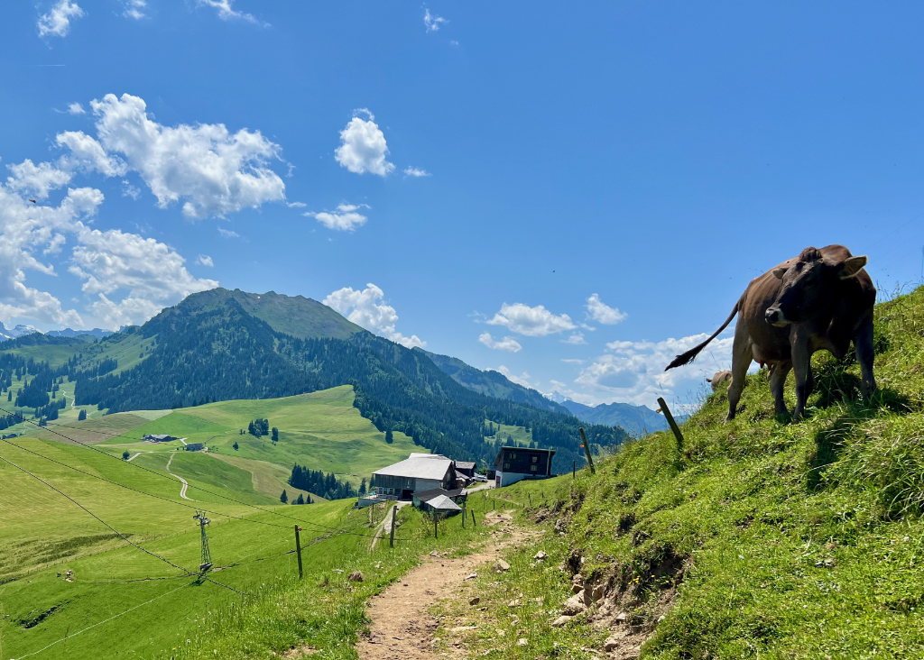
So although not what I had planned, the hike through the valley was nice with lots of pretty farmland and happy cows. When we got to Wirzweli, we stopped at a restaurant for an Aperol spritz. Always perfect on a hot day.
Getting Back
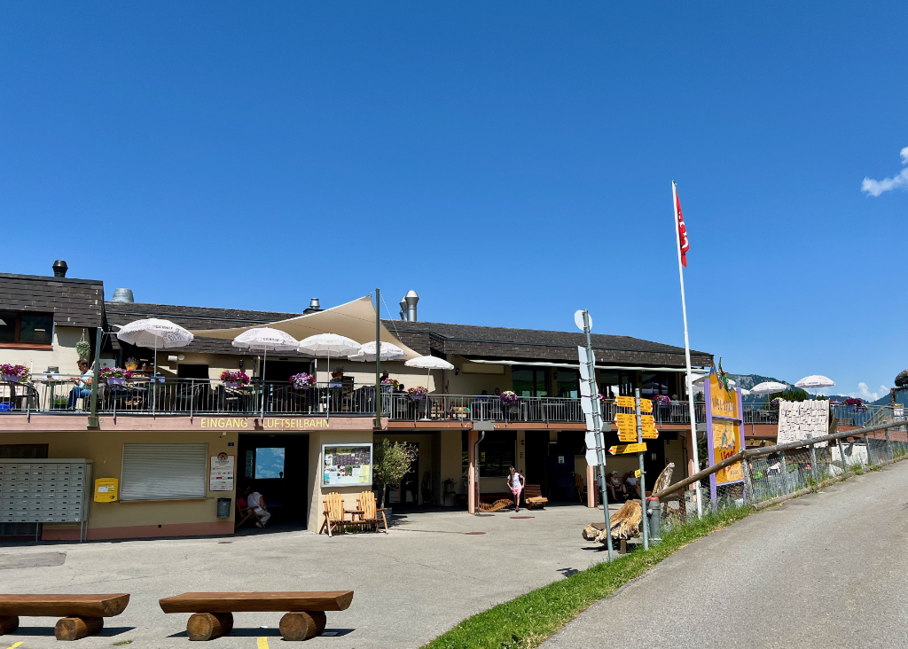
After we walked through Wirzweli, we came to the cable car station and took the cable car down to the valley.
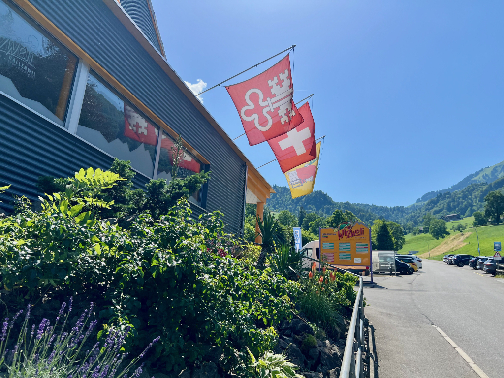
From the valley station, it is a 15 minute walk to the Dallenwil train station.
I enjoyed the hike and have it on my list do again sometime. And, if not the hike, maybe I’ll just go up to the Stanserhorn for one of their events. The views are fantastic!
Leave a Reply