
The Shaker Loop trail is 10.5 km long with 355 m ascent and descent. This loop took us through the Pittsfield State Forest reserve and past some historical points of interest for the Shaker religious order. If you are interested in learning more about the Shakers, touring the historic Hancock Shaker Village across the street from the trail head is highly recommended. Although this is a summit loop, there are no overlooks or grand views on this trail. Despite that, it was a very pleasant hike. It was also enough of a workout to feel like we had done something for the day. With the bare trees and muddy ground, April was not the best time of year for this trail. However, I can imagine it is a very lovely in the fall, as there seemed to be a really nice variety of trees on this trail.
Detail Summary
| Where: | Shaker Mountain Summit Loop Pittsfield, MA, USA |
| Car: | There is a pull-off parking area from Rt 20 at the trail head in Pittsfield, Massachusetts, just west of the junction of Routes 20 and 41. The trail head is across the road from the Hancock Shaker Village. Driving directions to Hancock Shaker Village can be found here. |
| What: | Shaker Mountain Summit Loop Trail Map and Guide: Shaker Trail Guide – Mass Park Info Trail is marked with a green triangle with a white dot in the center.  Shaker Loop Trail Marker |
| Skill: | Medium – About 3 hrs Length 10.5 km, Ascent 355 m, Descent 355 m |
| Cost | Fee to visit Hancock Shaker Village. |
Getting There
This hike is not accessible by public transportation, so we drove. The trail head is located on route 20 directly across from the Hancock Shaker Village. There is a pull-off parking area at the trail head. When we arrived, we were the only car in the lot.


To get started, we walked past the gate marking the trail entrance. We soon spotted our trail markers (a green triangle with a white dot in the center) and we were on our way.

The Trail
The first section of the trail took us past a pretty pond, the first of the Shaker historical sites, and into the woods. The historical sites have brief information signs. In the second picture below is a part of a steam boiler used in the textile mills. The bottom two pictures are the foundations of a former Shaker settlement and a dam, respectively.


After we crossed this bridge, we turned right and began the loop up to Shaker Mountain summit. At the summit, there isn’t a view or outlook, but there is a clearing that is a holy area for the Shakers known as the Mount Sinai Feast Ground.


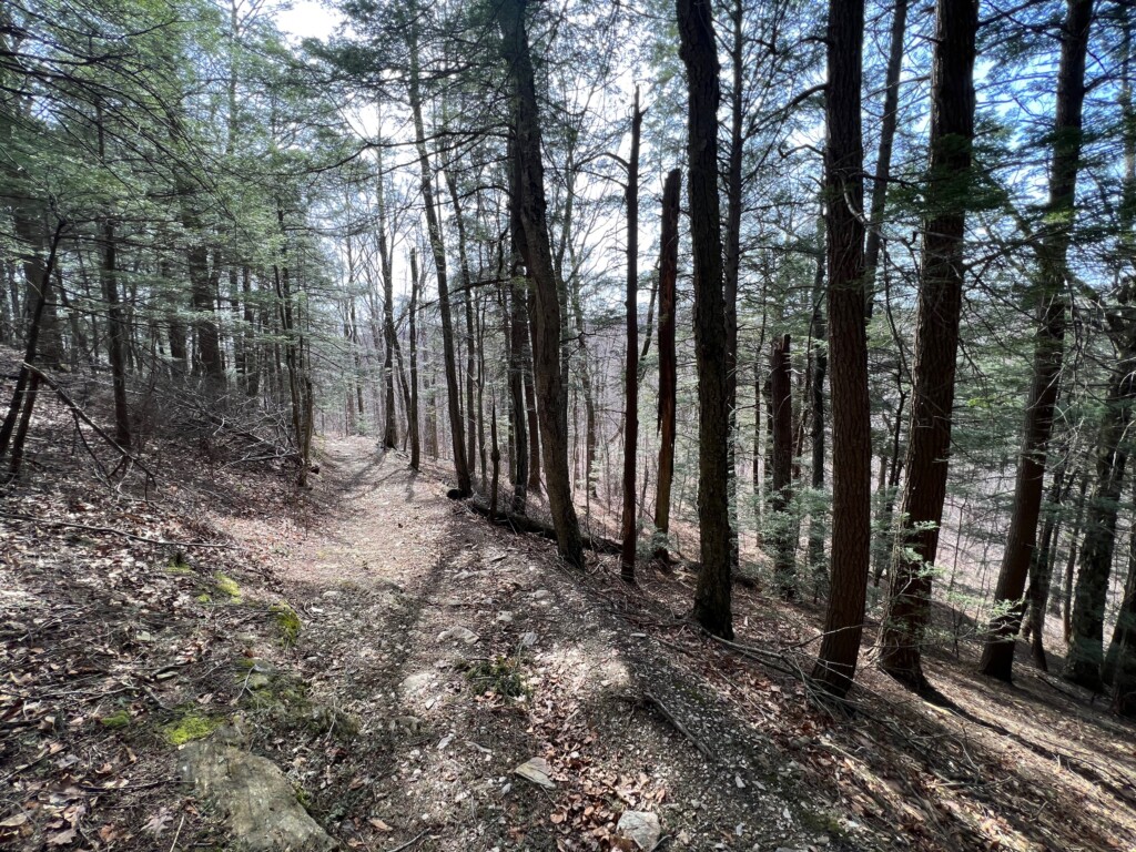
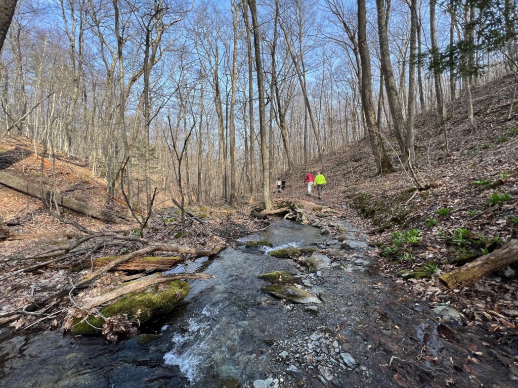
After passing the summit, we began the long loop back. The trail through the woods here had a nice variety of trees. It was also very muddy, with several stream crossings and sometimes it was challenging to keep our feet dry. Getting across the stream in picture three wasn’t the most difficult of the stream crossings on this trail.


As we continued to hike, we came across more of the Shaker historical areas, including the perfect stonewall in picture one and the Sacred Lot, a natural amphitheater used for prayer by the Shakers in picture two. Most of the trillium flowers we saw were not open, but there were a few in a sunny patch that were blooming. They are one of my favorite flowers, so I was very happy to spot one.


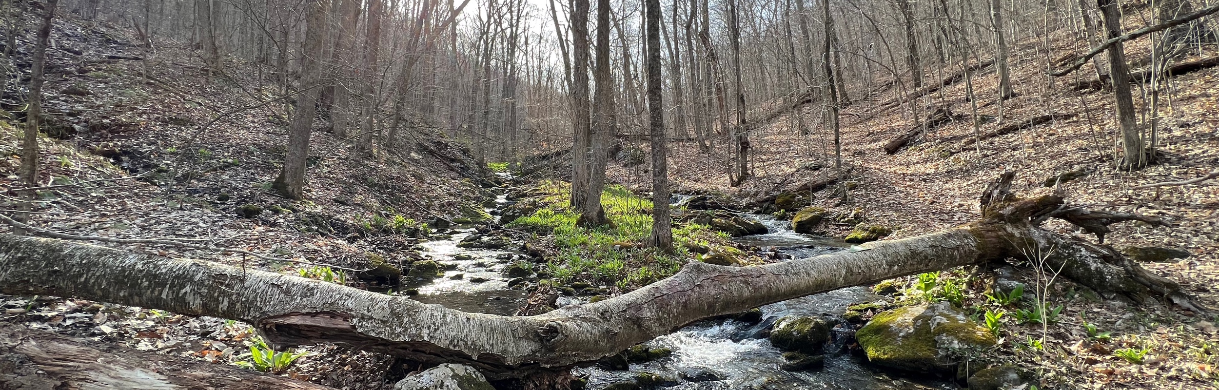
As I mentioned earlier, there were some challenging stream crossings. The picture below shows the most challenging one. Here, the best way to get across was to scoot along the log.

After crossing the stream, the trail continued along side the stream. When we spotted the bridge we had crossed at the start of the loop, we knew we were just about done.

From the bridge, all we needed to do was retrace our steps back past the pond and to the parking lot. We got some exercise, fresh air, and a bit of a history lesson, all making for a nice day out.
Leave a Reply