Hiking the Zürich-Zugerland Panorama Trail – Stage 1 Zürich (Triemli) to Albispass

The Zürich-Zugerland Panorama Trail (Trail 47) is a two stage trail from Zürich to Zug. The first stage includes a hike up to the top of Uetliberg, the highest local point overlooking Zürich, followed by a hike along the Albis Ridge, providing gorgeous panorama views and many picnic places along the way.
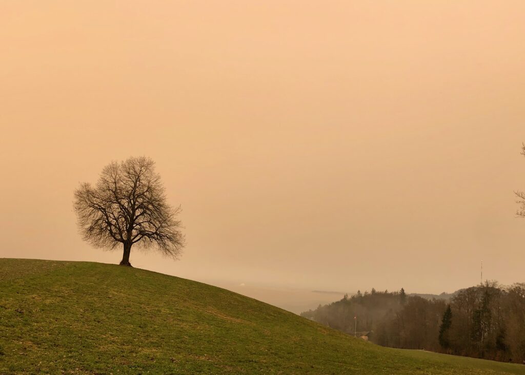
If you are looking at the picture above, thinking that it has an odd sepia tone to it, and wondering why I would use a picture like that for a travel blog, don’t worry, there is a good explanation. The red/orange color was caused by, believe it or not, sand from a wind storm in the Sahara! How wild is that? From what I’ve read, while not a completely unusual occurrence (it happens once or twice a year), this was a particularly thick storm, producing an unusually orange sky.
It just goes to show how unpredictable weather can be. But, just in case you are wondering what it looks like on a more typical day, I am including a few pictures from other hikes in this post.

| Where: | Zürich (Triemli) to Albispass, Canton Zürich, Switzerland |
| Train/Bus: | Zürich HB -> Triemli – 20 min Albispass – >Zürich HB – 40 min Note: Bus from Albispass only runs once an hour. |
| What: | Zürich-Zugerland Panorama Trail – Stage 1 |
| Skill: | Medium – About 4 hrs Length 13 km, Ascent 700 m, Descent 400 m |
Getting There
The Zürich-Zugerland Panorama trail is best done with public transportation as each stage starts and ends at different points. Stage 1 starts at the Triemli train station.


When there is a lot of snow, as there was the week before our hike, you can take a sled to the top of Uetliberg and sled all the way back to the train station at Triemli. You can see in the second picture the sign for the end of the “Schlittelweg” – Sledding Path. (We haven’t done this particular sled run as there is rarely enough snow but long sled runs are fabulous. Our favorite sled run is at Melchsee-Frutt.)
The Trail – Up to Uetliberg
From here, we began the climb up Uetliberg – a 470m elevation gain over 3 km through forest. In the third picture below, I’ve circled the people on the switchbacks above, to give you an idea of how steep the trail is. (I’m really selling this part of the trail, aren’t I?)


If you would rather skip this part, and join the trail when the view gets good, you can simply take the train to Uetliberg and join trail 47 at the top. Whether you’ve started the trail at the Triemli train station as we did, or took the train up, you will know you are nearing the top when you pass the Uetliberg radio tower and the mosaic deer lamps by the artist Bruno Weber.


The Trail – The Top of Uetliberg
When we reached the top of Uetliberg, we were rewarded with a wonderful panoramic view.


As this is a fantastic view point (and quickly and easily reached by train from Zürich), it was one of the first places we went after coming to Switzerland and it is one of our favorite places to take out of town guests. There is a viewing tower, restaurant, and hotel here. (Closed temporarily for Coronavirus. The take-away grill stand was open.) To give you an idea of what it looks like without a sky full of Saharan sand, here are two pictures from a summer hike we did in 2019 and one from a winter hike we did in 2016:


The Trail – Uetliberg to Albispass
After leaving the viewpoint, we headed down some steep stairs and begin the hike towards the Albispass. This part of the trail is also part of the Planetweg – a trail with a scale model of the solar system. If you started the trail at the Uetliberg train station, you probably already noticed the planets as you passed.


When we hiked the Planetweg on a clear day in December of 2017, I took this picture from the same spot as the third picture above.

As we continued the hike towards Albispass, the trail was fairly easy. We passed a farm with some very hairy looking pigs, where we bought some cheese, and we passed another restaurant. As you can see, the sky was strikingly orange.


About 6 km after leaving the Uetliberg viewpoint, we passed the Felsenegg gondola, which will take you down to Adliswil. When we did the Planetweg, this was where we ended the hike. Just passed the gondola is the Felsenegg restaurant.


I haven’t eaten at the Felsenegg Restaurant, but I’ve heard a lot of good things about it. Due to Coronavirus, it was only open for take-away when we hiked past. Still, even on a hazy, orange day, there was no denying it has a spectacular panoramic view.


I will definitely need to return here on a clear day. At this point, we still had another 4 km or so to go to get to the endpoint at Albispass.


The trail was fairly easy here, and after we passed the Buchenegg Restaurant, I was back on familiar ground. From Buchenegg to Albispass, the Zürich-Zugerland Panorama Trail joins with the Adliswil-Felsenegg Nordic Walking Park Buchenegg Trail which I hiked last October.
Getting Back
Once we reached the Albispass, the sky had begun to return to a more normal overcast color.


Here, we planned to catch the bus back home, but unfortunately, it only runs once an hour and we had just missed it. Oh well. I suppose I should have paid more attention to the time. Still, we had a nice day out. Looking forward to stage 2!


Leave a Reply