Hiking the Zürichsee-Rundweg Trail – Stage 10 Küsnacht to Bürkliplatz
When we started hiking the Zürichsee-Rundweg trail back in September, I said I hoped we’d get to do all 10 stages. And I am pleased to say we accomplished that goal. We had such marvelous weather one Saturday early November, that we hiked not only stage 9 (photo story here), but we continued on and completed stage 10 as well! While stage 10 doesn’t have the panorama views of earlier stages, it is still a pretty and varied hike with ponds, forest, farmland, ravines, cityscape, and, of course, the shore of lake Zürich. Stage 10 is also the final stage of this hike. It was so gratifying to return to our starting point at Bürkliplatz and to look over the lake and know we had completed every stage of the trail.

| Where: | Küsnacht to Zürich, Bürkliplatz, Canton Zürich, Switzerland |
| Train: | Zürich HB -> Küsnacht – 16 min Bürkliplatz – >Zürich HB – 10 – 15 min |
| What: | Zürichsee-Rundweg Trail – Stage 10 |
| Skill: | Easy – About 2 hr 55 min Length 11 km, Ascent 190 m, Descent 320 m |
| The Zürichsee-Rundweg is a ten stage trail that starts and ends in Zürich, Bürkliplatz and makes a complete loop around lake Zürich (including the Obersee). Photo stories for each stage here: Stage 1 – Zürich, Bürkliplatz–Adliswil Stage 2 – Adliswil–Horgen Stage 3 – Horgen–Richterswil Stage 4 – Richterswil–Pfäffikon SZ Stage 5 – Pfäffikon SZ–Schmerikon Stage 6 – Schmerikon–Rapperswil SG Stage 7 – Rapperswil SG–Stäfa Stage 8 – Stäfa–Meilen Stage 9 – Meilen–Küsnacht ZH Stage 10 – Küsnacht ZH–Zürich, Bürkliplatz |
Getting There
The Zürichsee-Rundweg trail is best done with public transportation as each stage starts and ends at different points. Stage 10 starts in Küsnacht in the Küsnacht ravine. We were hiking straight through from stage 9, so we simply crossed this bridge and continued on with the trail. (If we had taken the train to Küsnacht, we would have needed to hike up the ravine to this point to rejoin the trail.)
The Trail – Water and Woods
After crossing the bridge, the next part of the trail took us up many steps and out of the ravine. Here the trail passed two pretty ponds. The first is the long thin Schübelweiher pond. The second is the larger wider Rumensee. By the Rumensee, there are picnic tables and a WC – a nice location for a break.
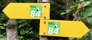
After passing the ponds, the trail heads into the woods. There are a lot of crisscrossing trails here, so we needed to keep an eye out for the markers and an eye on the map. It would be quite easy to take a wrong turn here.
While most of the trail is through the forest, there are occasional breaks of open field where we got a good view of the lake. Not quite the panoramas of the last few stages, but pretty nonetheless.
The Trail – In the City?
After about 4.5 kilometers, we were starting to see the first signs that we were really back in the city limits. It being November, there was a roasted chestnut stand (Heissi Marroni). As the trail passed through residential areas, we also came to a tram stop (Rehalp) – the first we had seen on this trail since stage 1.
After passing the tram stop, the trail headed into the Werenbach ravine. Despite going right through the heart of the city, we did not feel like we were in the city at all.
When we exited the ravine, I was surprised to see that we were right near the Zürich Tram Museum. On display in this museum are original vehicles from 1897 to 1960, along with engines, uniforms, Ticket machines, and a model layout of working trams. We’ve been there a few times and it is a lot of fun as you can walk though and on most of the historic trams. If you are looking for a rainy day activity for younger children (or tram enthusiasts), this is a nice choice.
After passing the Tram Museum, the trail continued to follow the stream (with a few detours due to construction), through the city and down to the lake. Just before reaching the lake, we passed a mosaic of a fish head and chicken foot. It was so odd that I had to include a picture of it here.
The Trail – Back to the lake
Right after the chicken foot mosaic, the trail comes to a park on the lake shore. Here we passed the Chinese Garden, a temple garden that was a gift from the city’s Chinese partner town of Kunming. We didn’t go in today, but we have been there before and can recommend it. After passing the garden, we were finally back at the lake shore.
The final part of the trail follows the historic quayside back to Bürkliplatz. Normally (i.e not Coronavirus times), this is a wonderful place to walk, but it was very crowded the day we were hiking (gorgeous weather and all). We were wearing masks, but seeing that many people out together (and ugh, being part of it), was anxiety inducing. Despite that, I did enjoy the sunset and water views.
End of the Hike
As the sun was setting we reached the end of the trail at Bürkliplatz – right back where we started in September.
Happy to be finished! But a little sad it is over. This was a really fun quest and it really helped to motivate us to get out, get walking and explore our local trails. We may even do it again in the spring just to see it all in a completely different season. Now on to other trails! So much to discover.


Leave a Reply