
The Dreiland Wanderweg or Three Country Trail (Trail 67) is a 43 km long, three-stage trail that explores the border triangle between Switzerland, Germany, and France. The first stage is 16 km with 200 m ascent and 190 m descent and remains entirely in Switzerland going from the Schifflände boat port in Basel to the Riehen, Hörnli Grenze bus stop on the border with Germany. Along the way, this trail provides a varied tour of the Basel area including old town city views, country fields, and riverside strolls.

Detail Summary
| Where: | Basel, Schifflände to Riehen, Hörnli Grenze Canton Basel-Stadt, Switzerland |
| Train/Bus: | Zürich HB -> Basel, Schifflände – 1 hr 30 min Riehen, Hörnli Grenze – >Zürich HB – 1 min hr 34 min |
| What: | Dreiland Wanderweg – Stage 1 (SwitzerlandMobility) |
| Skill: | Medium – About 4 hrs Length 16 km, Ascent 200 m, Descent 190 m |
Additional Info
| Dreiland Wanderweg Overview (SwitzerlandMobility) Dreiland Wanderweg – Stage 1 (SwitzerlandMobility) |
Photo Stories for all Stages
| The Dreiland Wanderweg, Chemin des Trois Pays, or Three Country Trail (Trail 67) is a 43 km long, three-stage trail that explores the border triangle between Switzerland, Germany, and France. Photo stories for each stage here: Stage 1 – Basel, Schifflände to Riehen, Hörnli Stage 2 – Riehen, Hörnli to Haltingen (Germany) Stage 3 – Haltingen (Germany) to Basel, Schifflände |
Getting There
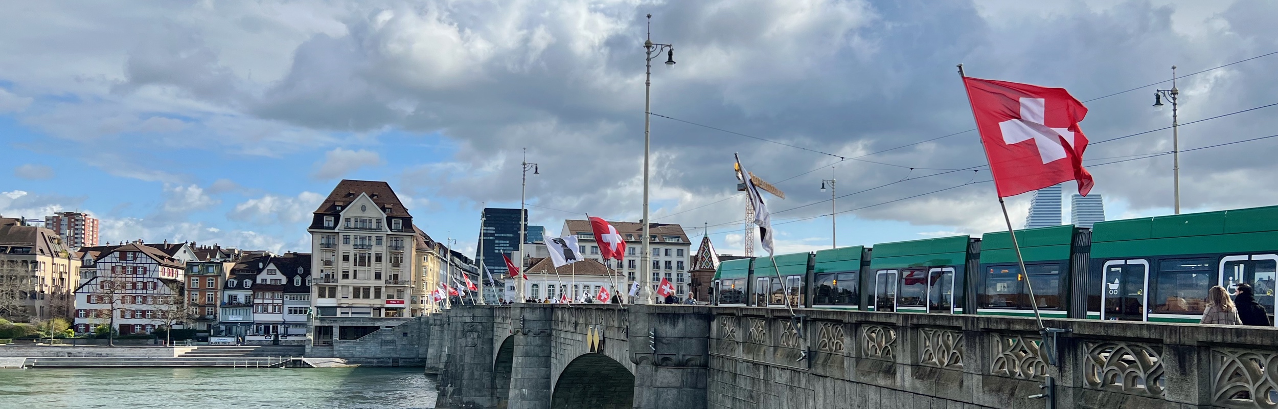
After getting off the tram at the Basel, Schifflände stop, we took a peek at the Rhine river before finding our trail sign hidden amongst some construction.


Once we found our sign and consulted the map to be sure we were going in the right direction, we were off. This trail goes through a lot of urban area and with so many cross streets, we really needed to keep an eye on the map as we wanted to make sure we didn’t get off the trail. But even if you do, Basel is a pretty city and fun to explore no matter how you do it.
The Trail
Not long after starting the trail, we came to Marktplatz, a market square in front of the ornate red City Hall building, the seat of the government and parliament for the canton of Basel-Stadt. There was a farmer’s market set up and everything looked so pretty. From Marktplaz, the trail continues through the Basel downtown.


We passed the Spielberg Welten Museum, a toy museum that we considered visiting, but decided to just admire the window displays instead and to press on with our hike. Maybe another time.


The trail follows a canal through the city until it reaches the Basel Zoo. We didn’t plan to visit the zoo, but we were hoping to catch a glimpse of the animals as the trail passed by, but it isn’t possible to see any animals from the trail. We did smell them, though.


After passing the Zoo, there is a short climb up the hill of St. Margerethen. At the top there were multiple signs warning us that this is private property and picnicking is not allowed, however, the views are lovely.


From there, the trail takes a turn into the countryside. There were even cows!


When we saw the watertower in the first picture below, we decided to take a short detour to check it out. It cost 1 CHF to go up the tower (automated machine, exact change or Twint payment only) and lots of stairs to climb to get to the top (see the tower diagram in the third picture below). I was a bit surprised to see a sign warning people that the launching of fireworks from the top of the tower was strictly forbidden, but I’m guessing that it is up from experience. The views from the top were fantastic. It wasn’t until I got back that I realized the sign we saw near the water tower for the Batterieanlage did not refer to the water tower, rather it refers to a military installation on the hill near the water tower (german).


After leaving the water tower, as we made our way back to the trail, my husband paused to take a picture of himself with a life-sized diplodocus statue. Then, we kind of speed-walked the next section of the trail as it was starting to rain and sleet.


When we reached the covered bridge, we decided to go off the trail in search of some lunch. We didn’t really get into the town of Munchenstein, so our impression of it as an industrial park may be misguided, but that’s what we saw of it. We did find a corner restaurant (picture two) where we stopped for some tortellini with morel mushrooms (no menu, just this lunch dish was available). The tortellini were nothing special but I did like the morels.


After lunch, we returned to the trail. Here, it follows the Birs stream. We were surprised at the quality of the FCB graffiti we saw, but we shouldn’t have been. This is where the trail goes right past the FC Basel football stadium, St. Jakob-Park.


The trail continues to follow the Birs stream until it flows into the Rhine river. Here, I was confused by the trail sign because it pointed in three different directions. One direction was obviously the direction we had just come from, but which way should we go between the other two – the one pointing upstream or the one pointing downstream? After looking at the map, we saw that if we went downstream it would simply take us back to the Schifflände boat port, and if you just want to do this stage of the hike and not the other two, that would be a good way to end the hike. We want to do the full three stage loop so we followed the path upstream.


After a short walk alongside the Rhine, we crossed the river at hydroelectric plant dam and lock.


After crossing the river, the path goes through some residential areas, gardens and past soccer fields. When we got to the bridge in the last picture above, we were at the end of stage 1.
Getting Back
The next stage of the trail continues just under the bridge, but we needed to turn the opposite direction to get to the Riehen, Hörnli Grenze bus stop and head home. The bus stop is just before the border to Germany.


Stage 1 of the Dreiland Wanderweg was an interesting hike, and gave me a new perspective on Basel. I’m looking forward to stage 2 and seeing what differences we’ll see when we cross the borders into Germany and France.
| ———-—- | | Next Stage >>>> |