
Hiking the Zürichsee-Rundweg Trail – Stage 2 Adliswil to Horgen

This past weekend I made a good start on my plan to hike around Lake Zürich on the Zürichsee-Rundweg Trail by completing both stages 1 and 2! Stage 1 was so much fun, we couldn’t wait to get to the next stage. Stage 2 picks up where stage 1 left off in Adliswil and ends in Horgen on the shore of Lake Zürich. With gorgeous views of the Sihl river and Lake Zürich, stage 2 was just as delightful as stage 1.
| Where: | Adliswil to Horgen, Canton Zürich, Switzerland |
| Train: | Zürich HB -> Adliswil – 23 min Horgen (See) -> Zürich HB – 22 min |
| What: | Zürichsee-Rundweg Trail – Stage 2 Adliswil to Horgen |
| Skill: | Easy – About 3 hr 10 min Length 12 km, Ascent 260 m, Descent 300 m |
| The Zürichsee-Rundweg is a ten stage trail that starts and ends in Zürich, Bürkliplatz and makes a complete loop around lake Zürich (including the Obersee). Photo stories for each stage here: Stage 1 – Zürich, Bürkliplatz–Adliswil Stage 2 – Adliswil–Horgen Stage 3 – Horgen–Richterswil Stage 4 – Richterswil–Pfäffikon SZ Stage 5 – Pfäffikon SZ–Schmerikon Stage 6 – Schmerikon–Rapperswil SG Stage 7 – Rapperswil SG–Stäfa Stage 8 – Stäfa–Meilen Stage 9 – Meilen–Küsnacht ZH Stage 10 – Küsnacht ZH–Zürich, Bürkliplatz |
Getting There
This trail is best done with public transportation as each stage will start and end at different points. Stage 2 starts at the Adliswil train station, about a 25 min ride from Zürich HB. After arriving at the train station and just a short walk down to the river, we were right back to were we left the trail at the end of stage 1.

The Trail – Along the Sihl River
The trail follows along the left bank of the Sihl river through Adliswil. The first few kilometers felt a bit industrial, with parking lots, industrial buildings, and man-made concrete steps in the river, but, there were still many pretty sights.


Eventually the trail leaves Adliswil behind and enters the forest. Here, even though the trail parallels the river, we mostly could not see it as the view was completed blocked by foliage. (This trail might be prettier in the winter when you can get a better view of the water.) Occasionally, it opened up and we got a good view.


After about 4 km, the trail crosses the road (Gatikonerstrasse) and leaves the riverside to follow the train tracks. This is, however, a brief change and soon enough (less than a km), the trail is alongside the river again.


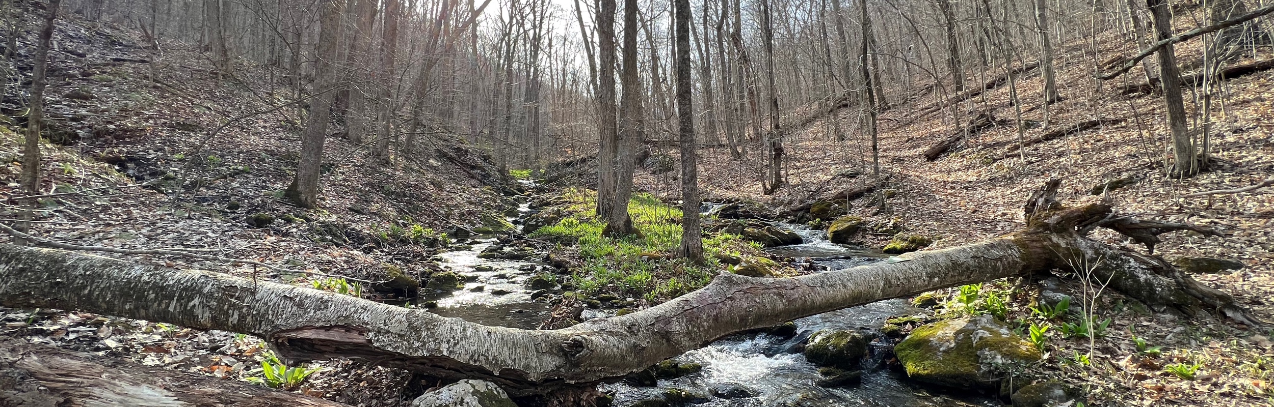
The Trail – Wildnispark Zürich Sihlwald
The trail continues along the Sihl river and about 2 km after crossing the street, it enters the Wildnispark Zürich Sihlwald. This is a lovely park with many trails and beautifully preserved forest land. Shortly after passing the sign letting us know we had entered the park, we came to a covered bridge. On the other side of this bridge is a playground, restaurant, and a nature center with a small museum. We’ve visited the museum before and it is a cute little place.


This time, we were were hiking through, so we didn’t linger and simply got back to hiking the trail.
The Trail – Up Through the Woods
Another km down the trail, the trail briefly merges with a paved path, before it very quickly diverges again and heads into the woods. At this point, there were a lot of trail intersections and it took us a minute to be sure we were on the right trail. In the first photo below, my husband is standing where the trail leaves the paved path and enters the woods. Up to this point, the trail had been relatively flat, but that changed here. Going through the woods, the trail is a bit of a climb at times, with both steps and a few steep switchbacks.


As the trail nears the top of the ridge it passes a wetland area. There is a wooden path into the wetland if you want a closer look. We hike these trails often, but I have yet to take the wooden path into the wetlands. Maybe next time. The forest and trails here are very well maintained and as you can see in the second picture, the forest service has been very busy. So much perfectly cut and stacked firewood!


After passing the firewood stack, we went under the highway (A3), where the trail soon exits the forest.
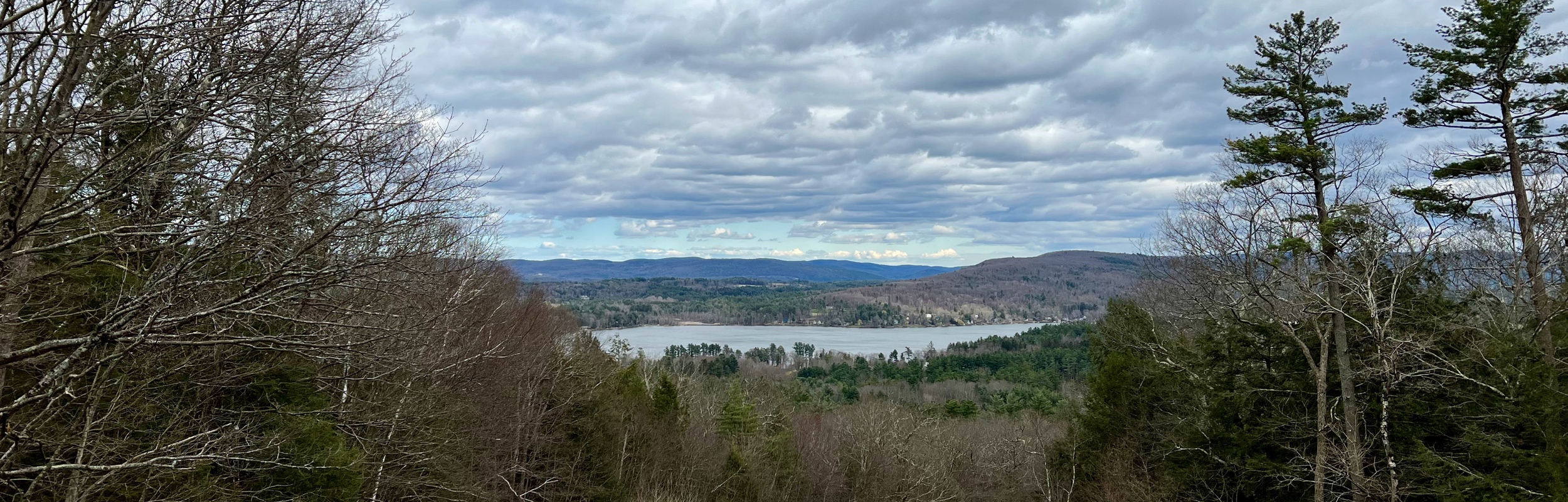
The Trail – Along the Ridge
When the trail exits the forest, it is at one of my favorite view points. Even on a cloudy day, it is beautiful.

And, if you happen to be here on a sunny day, it is absolutely fabulous! Here is a photo from a previous hike:

At this viewpoint, the trail heads to the right along the ridge and past a shooting club. On Friday nights, the club is active and some of the trails are closed. As the trail continues along the ridge, there are many wonderful views of the lake. There is also a great place to stop for a break to just sit and enjoy the view.


The Trail – Through Town
When the trail is just above the center of Horgen, it heads down into town. There are several switchbacks here and many intersecting trails, so we needed to pay close attention to the trail markers. The trail through town took us past the upper Horgen train station and our favorite Indian restaurant, Chalet India. Fantastic food and we highly recommend them.


Walking from the upper train station to the lower train station (the end of stage 2) took about 15 minutes. The trail was under construction when we hiked, so we needed to take a detour, but soon enough we were at the end.
Getting Back
The end of stage 2 is the Horgen (See) train station where there is a lovely fountain.

We took some time to admire the Horgen fountain and the lake view before heading home. Can’t wait to do stage 3!
Leave a Reply