Hiking the Trans Swiss Trail – Stage 19 Stans to Seelisberg

Stage 19 of the Trans Swiss trail is 20 km long with 820 m ascent and 480 m descent and goes from Stans to Seelisberg. This stage was filled with beautiful views of the Vierwaldstättersee both from shore and from above. There was also a steep ascent through the Risleten Gorge past a really gorgeous waterfall. This was a wonderful hike and one of the prettier stages we’ve done so far.

| Where: | Stans to Seelisberg Canton Nidwalden and Canton Uri Switzerland |
| Train/Bus: | Zürich HB -> Stans – 1 hr 20 min Seelisberg, Dorf -> Zürich HB – 2 hr 33 min |
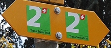
| What: | Trans Swiss Trail – Stage 19 – Stans to Seelisberg Yellow trail markers Red and White- Trans Swiss Trail Route 2 One section is a red and white mountain trail |
| Skill: | Medium – About 5 hrs 50 min Length 20 km, Ascent 820 m, Descent 480 m |
| Stage 1 – Porrentruy to St-Ursanne Stage 2 – St-Ursanne to Soubey Stage 3 – Soubey to Saignelégier Stage 4 – Saignelégier to St-Imier Stage 5 – St-Imier to Chézard-St-Martin Stage 6 – Chézard-St-Martin to Neuchâtel Stage 7 – Neuchâtel to Murten Stage 8 – Murten to Laupen Stage 9 – Laupen to Bern Stage 10 – Bern to Worb Stage 11 – Worb to Lützelflüh Stage 12 – Lützelflüh to Langnau i.E. Stage 13 – Langnau i.E. to Eggiwil Stage 14 – Eggiwil to Schangnau Stage 15 – Schangnau to Sörenberg Stage 16 – Sörenberg to Giswil Stage 17 – Giswil to Flüeli-Ranft Stage18 – Flüeli-Ranft to Stans Stage 19 – Stans to Seelisberg Stage 20 – Seelisberg to Erstfeld Stage 21 – Erstfeld to Wassen Stage 22 – Wassen to Andermatt Stage 23 – Andermatt to Passo del San Gottardo Stage 24 – Passo del San Gottardo to Airolo Stage 25 – Airolo to Osco Stage 26 – Osco to Anzonico Stage 27 – Anzonico to Biasca Stage 28 – Biasca to Bellinzona Stage 29 – Bellinzona to Tesserete Stage 30 – Tesserete to Lugano (Comano) Stage 31 – Lugano (Paradiso) to Morcote Stage 32 – Morcote to Mendriso |
Getting There
The Trans Swiss Trail is best done with public transportation as each stage starts and ends at different points. Stage 19 picks right up where stage 18 left off, a short walk from the Stans train station.


To get to the start of our hike we walked up past the Winkelried Memorial (picture 2 above), a fountain dedicated to the memory of Arnold von Winkelried. During the Battle of Sempach, Arnold von Winkelried threw himself onto the pikes of the defensive front sacrificing his life to open a passage for the Swiss Confederacy leading to victory. After admiring the monument, we found our trail sign and we were on our way.
The Trail
The trail starts in town, but soon heads out into the fields, where we had lovely mountain views ahead of us.


Just after crossing the stream in the picture above, we began a short bit of ascent providing us with a lovely view back of Stans and an overview of the airport (picture one).


The trail then begins winding its way down to the lake, first passing through the town of Buochs. The views across the lake were spectacular. The last two pictures below are from where we stopped at a bench to have our picnic lunch.


After we had our lunch, the trail took a few ups and downs through the forest. Just before reaching Risleten Gorge, we came to a picnic area in Breckenreid where dinosaur tracks were found. Don’t expect to see the tracks unless you are rock climbing with a guide who knows where they are, as the tracks are faint and located on the upper flat cliff face in picture two. We talked to a rock climber there who said he’s climbed these rocks many times and still isn’t sure he’s seen them. Just past the dinosaur track area, the trail begins the steep climb up through Risleten Gorge, going past a wonderful waterfall. The dinosaur tracks may have been a bit of disappointment, but the waterfall certainly wasn’t. Beautiful!


After climbing up out of the gorge, the trail had absolutely stunning views of the Vierwaldstättersee.


As we neared the end of the hike, I a snapped a few final picture of the lake behind us and the mountains ahead.


This was a warm day so it was good to be almost done.
Getting Back
When we reached Seelisberg, we quickly found the Seelisberg, Dorf bus station, and the end of the hike.


Since it was a ten minute wait for a three minute bus ride or a ten minute walk to the Seelisberg funicular station, we decided to just walk to the station. There, we caught the funicular down and headed home. This was a long hike, but also a very rewarding one. I really enjoyed this stage, and as always, I am looking forward to the next one.


Leave a Reply