
Hiking the Trans Swiss Trail – Stage 13 Langnau i.E. to Eggiwil
Stage 13 of the Trans Swiss trail is 12 km and goes from Langnau i.E. to Eggiwil. With 600 m of ascent and 540 m of descent, it is a solid hike. With gorgeous views over the hills and valleys of the Emmental region and of the distant Alps, this stage made for a perfect October day out.
| Where: | Langnau i.E. to Eggiwil Canton Bern, Switzerland |
| Train/Bus: | Zürich HB -> Langnau i.E. – 1 hr 44 min Eggiwil -> Zürich HB – 2 hr 7 min |
| What: | Trans Swiss Trail – Stage 13 Langnau i.E. to Eggiwil Yellow trail markers – Trans Swiss Trail Route 2 |
| Skill: | Medium – About 3 hrs 40 min Length 12 km, Ascent 600 m, Descent 540 m |
| Stage 1 – Porrentruy to St-Ursanne Stage 2 – St-Ursanne to Soubey Stage 3 – Soubey to Saignelégier Stage 4 – Saignelégier to St-Imier Stage 5 – St-Imier to Chézard-St-Martin Stage 6 – Chézard-St-Martin to Neuchâtel Stage 7 – Neuchâtel to Murten Stage 8 – Murten to Laupen Stage 9 – Laupen to Bern Stage 10 – Bern to Worb Stage 11 – Worb to Lützelflüh Stage 12 – Lützelflüh to Langnau i.E. Stage 13 – Langnau i.E. to Eggiwil Stage 14 – Eggiwil to Schangnau Stage 15 – Schangnau to Sörenberg Stage 16 – Sörenberg to Giswil Stage 17 – Giswil to Flüeli-Ranft Stage18 – Flüeli-Ranft to Stans Stage 19 – Stans to Seelisberg Stage 20 – Seelisberg to Erstfeld Stage 21 – Erstfeld to Wassen Stage 22 – Wassen to Andermatt Stage 23 – Andermatt to Passo del San Gottardo Stage 24 – Passo del San Gottardo to Airolo Stage 25 – Airolo to Osco Stage 26 – Osco to Anzonico Stage 27 – Anzonico to Biasca Stage 28 – Biasca to Bellinzona Stage 29 – Bellinzona to Tesserete Stage 30 – Tesserete to Lugano (Comano) Stage 31 – Lugano (Paradiso) to Morcote Stage 32 – Morcote to Mendriso |
Getting There
The Trans Swiss Trail is best done with public transportation as each stage starts and ends at different points. Stage 13 picks right up where stage 12 left off – the Langnau i.E. train station.
The Trail
After briefly retracing our steps from stage 12, we crossed the Ilfis creek and were back on the main trail. From there, the trail begins the ascent through the forest.
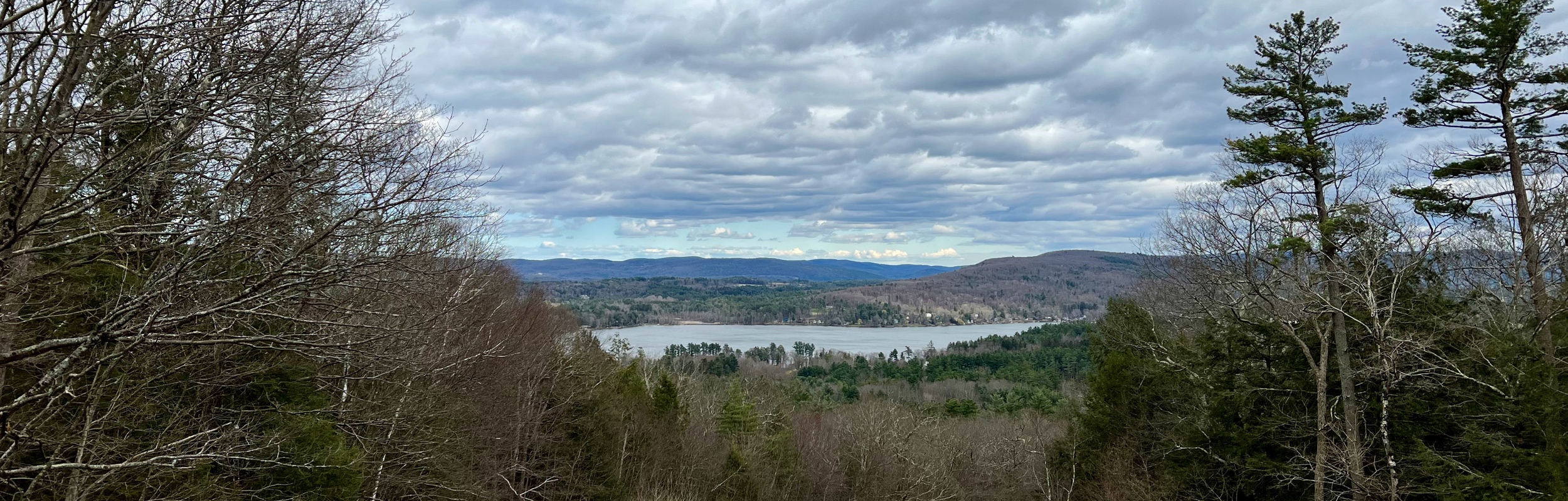
After about 5 km, we had reached the sitting area in picture three. We took a break and admired the beautiful view. With blue skies, green fields, and trees tinged with orange and yellow, it was a feast for the eyes.
October was a great time to hike this trail and I loved the changing leaves – so pretty! The tunnel in the second picture is called the “Hegenloch” and according to the sign on it, it was built in 1839/40 and is one of the first tunnels in Switzerland.
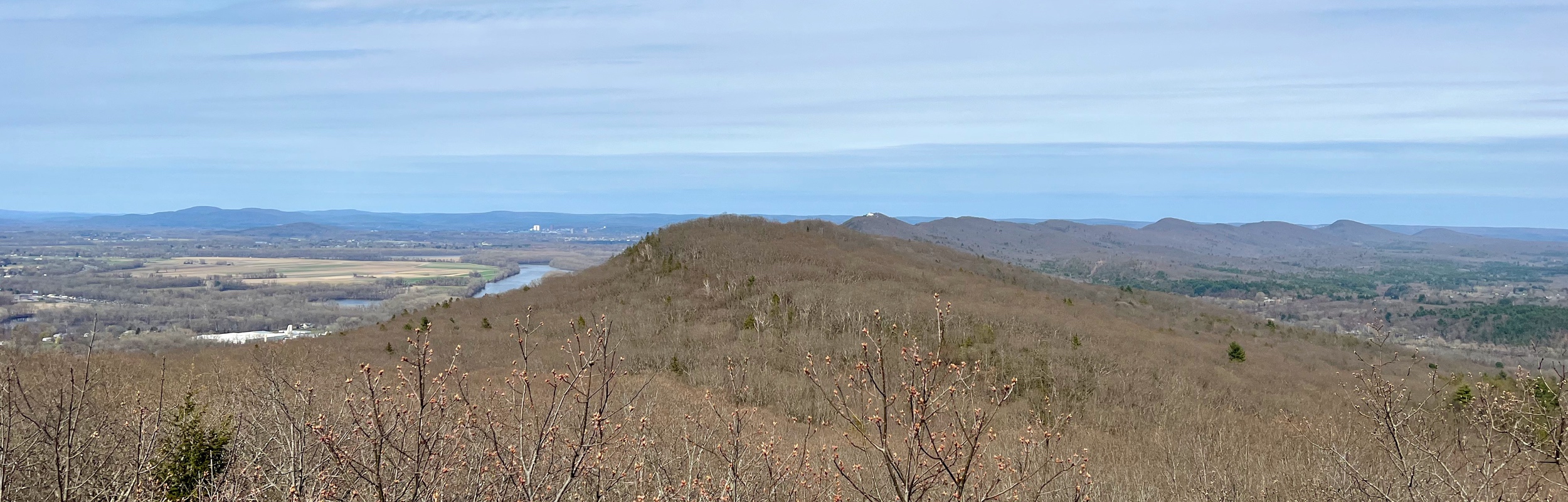
As the trail continued through the pastures, fields, and forest, there were often wide open views to the Alps. The overlapping misty layers were very beautiful but also very difficult to capture on camera.
In the first picture below, you can see the endpoint of the hike – the town of Eggiwil.
Getting Back
After crossing the bridge into Eggiwil, we reached the end of stage 13. It was then a short walk (7 minutes, maybe) to the bus station.
Although I didn’t write much about stage 13, I really did think it was a nice trail. And, if you want to do a hike in the Emmental region, I would definitely recommend it. We will continue with stage 14 as soon as we can, but with the days getting shorter and colder, it may not be for a while.
Leave a Reply